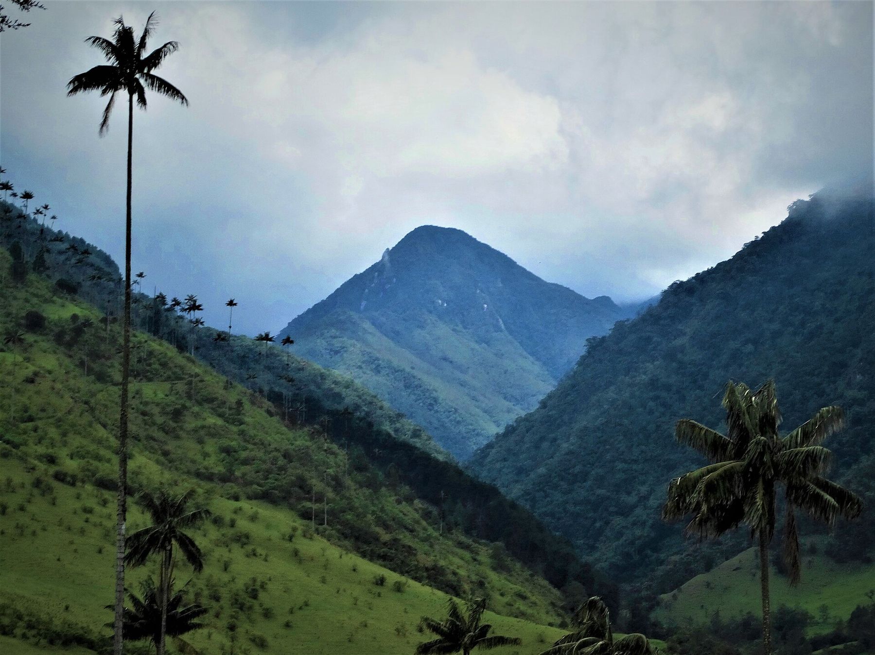
Salento sits on a ridge in the department of Quindío, in Colombia's coffee country, at 1,895 metres. It is a small town of one-storey and two-storey houses with thick walls, wooden balconies and doors and window frames painted in strong colours: red, green, yellow, blue. Below it the land falls away in green folds toward the Quindío River. Above it, a narrow road runs east up a valley to Cocora, where the national tree of Colombia grows in a way you will see nowhere else.
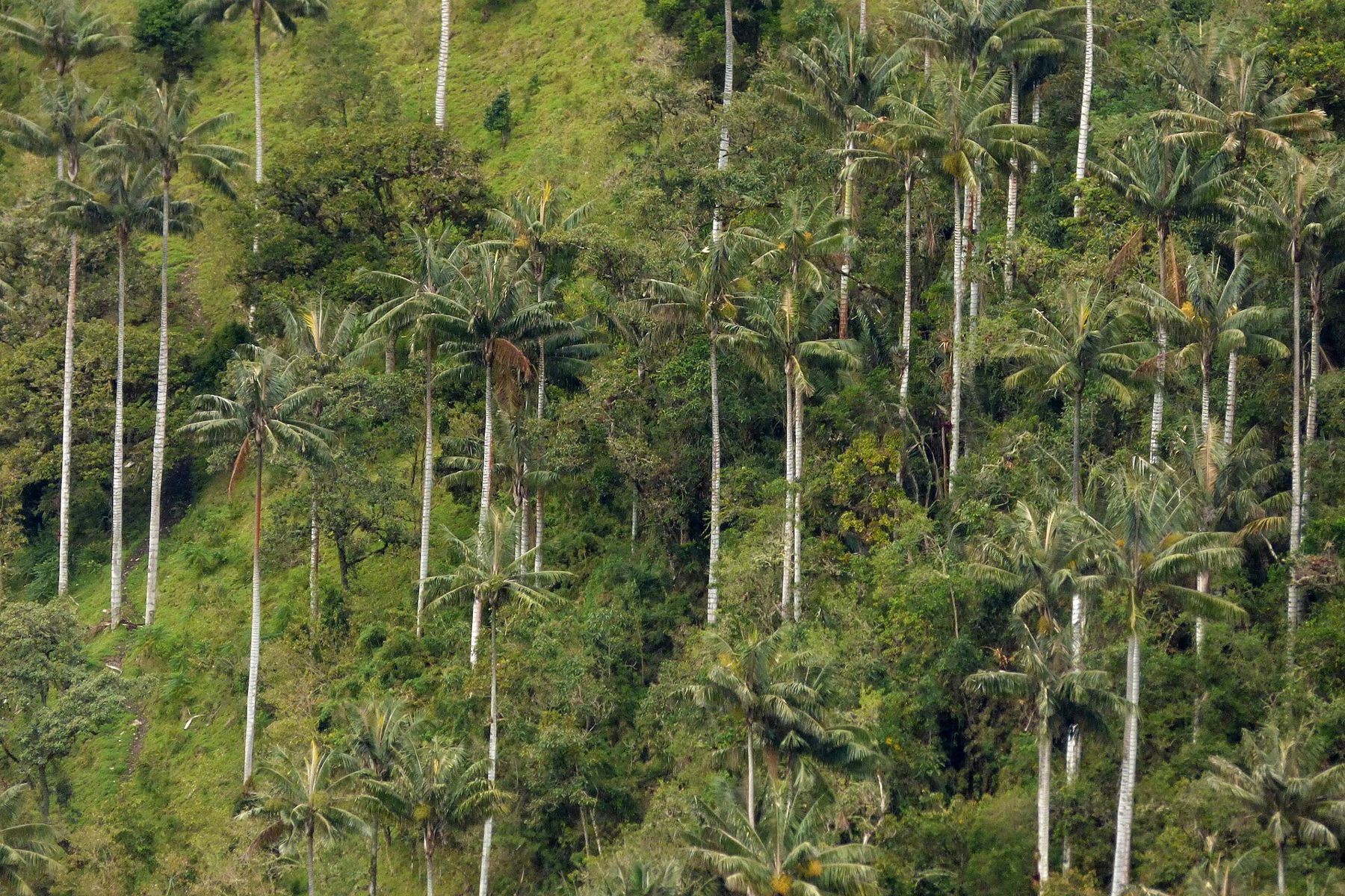
The Quindío wax palm is the tallest palm in the world. Its slender grey trunk, coated in a pale wax, can rise to well over 50 metres before it ends in a small crown of leaves. In the Cocora Valley the palms stand in open pasture on steep hillsides, spaced out like the masts of ships, their tops often lost in the cloud.
The air and the rain
At this height the air is soft and clean, and you will not feel the altitude in town. Walking in the Cocora Valley takes you higher, toward 2,400 metres and beyond on the upper part of the loop, and the climbs there are steep enough to leave you breathing hard. Go at your own pace and stop when you need to.
The real condition here is rain. The coffee country is green because it is wet, and it rains in every month, often heavily in the afternoon. Mornings are usually the clearest time. The drier months are roughly December to February and June to August, but drier is relative. The days are mild, the nights are cool enough for a sweater, and the sun is strong when it breaks through. Pack a rain jacket, a warm layer and shoes you do not mind ruining.
Day 1: Calle Real and the mirador
Calle Real is the main street, running from the plaza toward the edge of the ridge. It is lined with craft stalls, coffee counters and houses painted in two or three colours each. At weekends it fills with visitors from Colombian cities, and on weekday mornings it is quiet.
At the end of the street a long flight of steps climbs to a viewpoint known as the Alto de la Cruz. From the top you look down the Cocora Valley toward the mountains and back over the roofs of the town. It is a good first test of your legs. The climb is short but steep, and at this altitude most people stop at least once.
In the evening, look for a game of tejo, a Colombian sport in which players throw a heavy metal disc at a clay board set with small packets of gunpowder. A good throw ends in a bang. It is played in halls around the region, usually with beer.
Day 2: Into the Cocora Valley
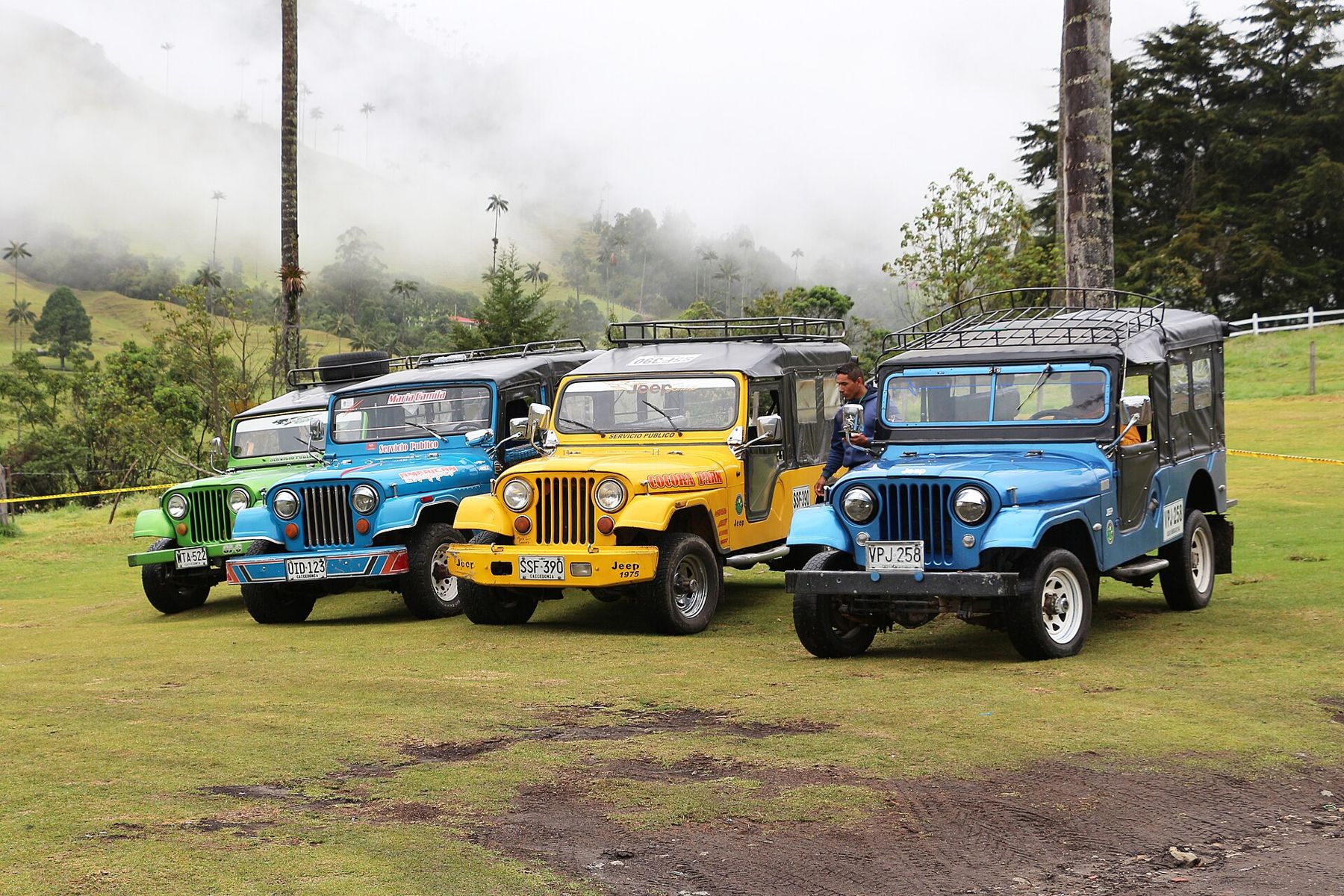
The jeeps leave from the plaza. They are old Willys, painted bright colours and packed with passengers inside, with more people standing on the back bumper holding the roof rack. The ride takes you east along the Quindío River for about half an hour, through pasture and cloud forest, to the small settlement at the head of the valley.
From there, most visitors walk a loop of several hours. The usual direction runs first up the river through cloud forest, crossing it again and again on narrow suspension bridges of wood and wire. The trail is muddy, rocky and steep in places. Higher up, a side trail leads to a reserve where hummingbirds come to feeders in the forest. Then the path climbs steadily to a high point on the ridge before dropping back down through open pasture, where the wax palms stand all around you.
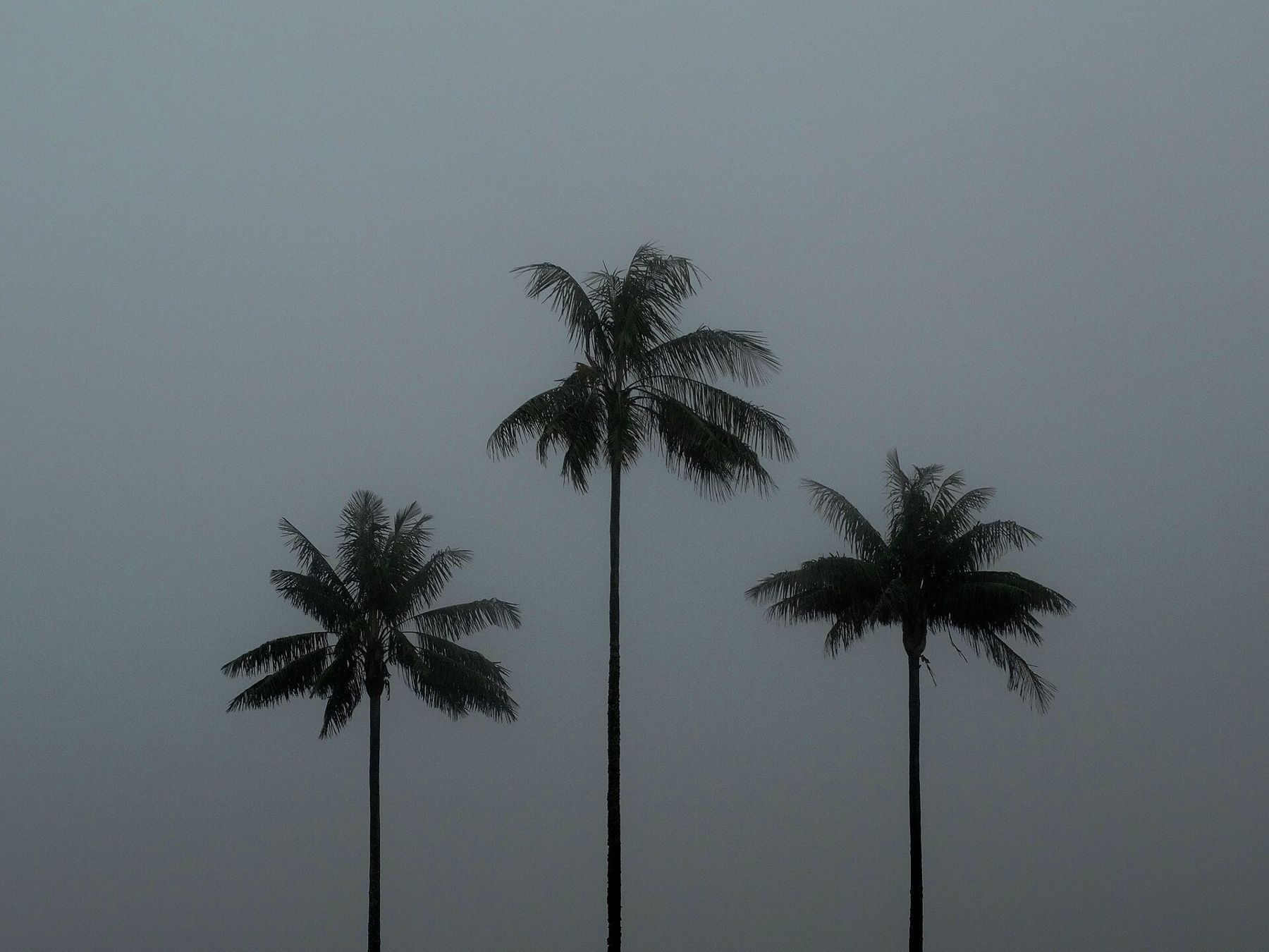
That last section is the reason to come. The palms rise from the grass on every side, singly and in groups, their trunks pale and straight, the wind moving their crowns far above. When cloud drifts down the valley, the tops disappear and reappear. Many visitors walk the loop in the other direction to reach the palms first while the light is good. Either way, start early.
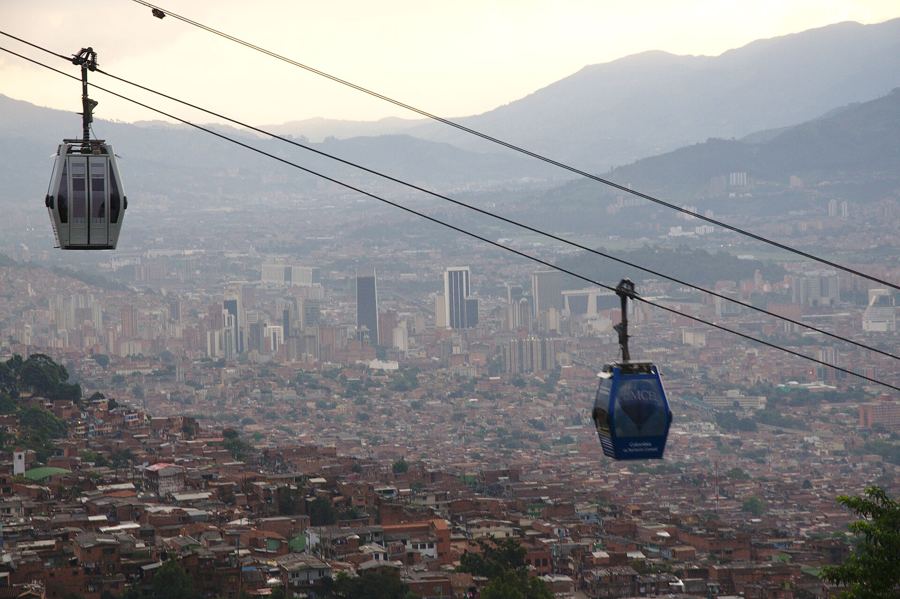 1,495 mMedellín, where the metro takes to the air
The wax palm grows slowly and lives a long time, and it is protected by law in Colombia. Its numbers fell badly in the past, when the wax was scraped from the trunks for candles and the leaves were cut for Palm Sunday. The palms in the open fields of Cocora stand on land that was cleared for cattle long ago, and young palms struggle to grow in open pasture. Stay on the paths, take nothing, and do not carve or scrape the trunks.
Wear boots or old trainers, take water, a snack, a rain jacket and a warm layer, and give yourself the whole day. The jeeps run back to Salento through the afternoon.
Day 3: A coffee farm
The hills around Salento are covered with small coffee farms, many of them family-run, and several open to visitors. A walk round a farm shows the whole cycle: the shaded rows of bushes on steep slopes, the red cherries picked by hand, the pulping that separates the beans from the fruit, the drying racks and patios, and the roasting at the end.
The Coffee Cultural Landscape of Colombia was listed by UNESCO in 2011. The listing recognises the way generations of small farmers have worked these slopes, a landscape of farms, towns and hillside plots built around coffee. Ask about the harvest when you visit; the main picking seasons in this region come twice a year, and a farm in harvest is a busy place.
Most farms near Salento are an hour's walk or a short ride from town. The walk out takes you past bamboo groves, banana plants and coffee rows, and down into small valleys where streams cross the road.
Day 4: Filandia
Filandia is another coffee town on a ridge, north of Salento toward Pereira. It is similar in style, with painted houses, balconies and a church facing the main square, but it sees fewer visitors. On its edge, a tall wooden lookout tower gives views across the coffee hills toward the central range of the Andes on clear days.
It makes a good contrast. Salento is busy at weekends; Filandia keeps a quieter, more everyday rhythm, with farmers in town for supplies and cafés full of local people rather than visitors.
Eating and sleeping
The town's best known dish is trout, raised in cold mountain streams nearby and served fried, grilled or with a sauce, often on a crisp patacón, a flattened fried plantain. Coffee is everywhere, of course, and the best of it is often in the smallest places.
Book ahead for weekends and holidays, when Colombian families arrive from the cities. Midweek is calmer and easier.
Pacing the days
Salento needs no altitude adjustment for most people, but the Cocora walk is a long day with real climbing, and the upper section is higher than the town. Do it on your second day, after a night's sleep, rather than on the day you arrive. Drink water even when it feels cool and damp, and do not underestimate the sun on the open pasture when the cloud lifts.
The trail can be slippery after rain. Walking poles help. If the weather closes in, the shorter walk straight up into the palm fields and back is still worth it.
Where the profile goes next
From here, the route north climbs down to the valley city of Medellín, where the cable cars run over the hillsides. To the east, across the central range, Bogotá sits nearly a thousand metres higher, on the cold savanna with La Candelaria's colonial streets. Farther south along the Andes, the next big step up is Ecuador, where the old town of Quito lies close to 2,850 metres.
But first, one more morning in Cocora, early, before the jeeps fill up: the grass wet, the palms standing in the mist, and the sun just touching their crowns.