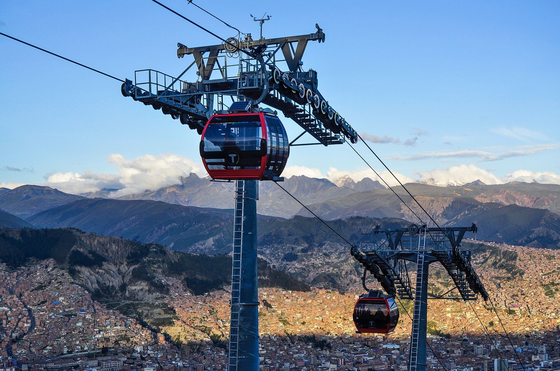
La Paz does not sit on the altiplano so much as fall into it. The high plain runs flat and brown towards Lake Titicaca, then breaks open into a canyon several hundred metres deep, and the city pours down its sides in red brick and corrugated roofing. The centre lies at about 3,640 metres. The rim, where El Alto spreads to the horizon, is higher still. Between the two, since the first lines opened in 2014, cabins of the Mi Teleférico network climb and drop on cables like beads on a wire.
That shape decides how you walk here. Every street is a slope, and every slope is at an altitude where the air holds roughly two-thirds of the oxygen it does at sea level. On the first day you will feel it on the first flight of stairs: a heavy chest, a pulse that does not settle, a mild headache by evening. Walk downhill when you can, ride uphill when you can, drink water, and stop for a sit-down long before you think you need one. The sun is fierce at midday and the shade is cold, so dress in layers you can peel off and put back on. Nights are cold all year.
This walk covers the old centre in a morning, a cable-car ride to the rim and back, and a viewpoint at dusk. Allow a full day, and do it on your second or third day in the city, not the first.
Plaza Murillo
Start where the country is governed. Bolivia has two capitals: Sucre holds the constitutional title and the supreme court, while La Paz is the seat of government, and Plaza Murillo is where that government lives. The square is small, planted with palms and crowded with pigeons, and on most mornings there are more people sitting on its benches than walking through it.
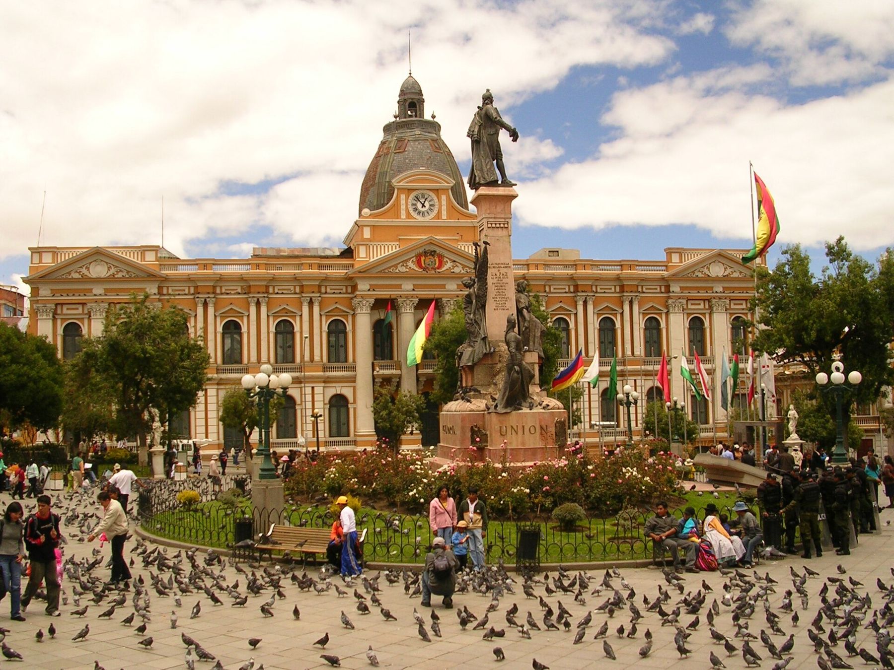
On the south side stands the Palacio Quemado, the Burnt Palace, a neoclassical front that takes its name from a fire during one of the nineteenth century's uprisings. Beside it rises the cathedral, a heavy stone building finished long after it was begun, and the legislative palace fills another side. A much taller government tower now rises behind the old palace. Soldiers in period uniform stand guard, and the square is often the stage for marches and speeches; if one is under way, watch from the edge and move on.
Calle Jaén
A few blocks north-west of the square, Calle Jaén is the one street in central La Paz that still looks the way much of the city did in the colonial period. It is short, cobbled and steep, with whitewashed and painted houses, wooden balconies and heavy doors. Several of those houses are now small municipal museums, including one of musical instruments, and the street is quiet enough that you hear your own footsteps.
Take it at a stroll. This is a good place to notice how your body is coping: if a gentle slope here leaves you short of breath, the afternoon's plan should be gentle too.
Basílica de San Francisco
Walk down towards the main avenue, the Prado, and the stone church of San Francisco appears above its plaza. The facade is the reason to come. It is carved in the mestizo baroque style of the Andes, with Indigenous faces, local fruit, birds and masks worked into the stone alongside saints and scrolls. Inside it is dark, gilded and cool.
The plaza in front is one of the city's meeting places: shoe-shiners in balaclavas, street vendors, preachers, students. It is also where many marches gather before heading up towards Plaza Murillo. Keep your bag in front of you, as in any crowded square.
Witches' Market streets
Behind the church, the streets climb again, and around Calle Linares and Calle Santa Cruz the stalls start to sell things that are not for tourists.  3,656 mThree days on the salt This is the area known in English as the Witches' Market. The stock is for offerings to the Pachamama, the earth mother: bundles of herbs, coloured sugar tablets, tiny figures of houses and cars, small bottles and powders, and the dried llama foetuses that are buried under the foundations of new buildings for luck.
It is a working market for people's beliefs, not a show. Ask before you photograph a stall, accept a no, and buy something if you have spent a while looking. The streets around are full of wool shops and weaving, and they all run uphill, so take the climb in short stretches.
Red Line lower station
From the market, take a taxi or walk down to the old railway station on the north-west side of the centre, where the Red Line begins. This is the moment the city's shape makes sense. The cabin lifts off and climbs over rooftops, a cemetery, football pitches on flat roofs and houses built at angles that look impossible, and the canyon walls draw closer on both sides.
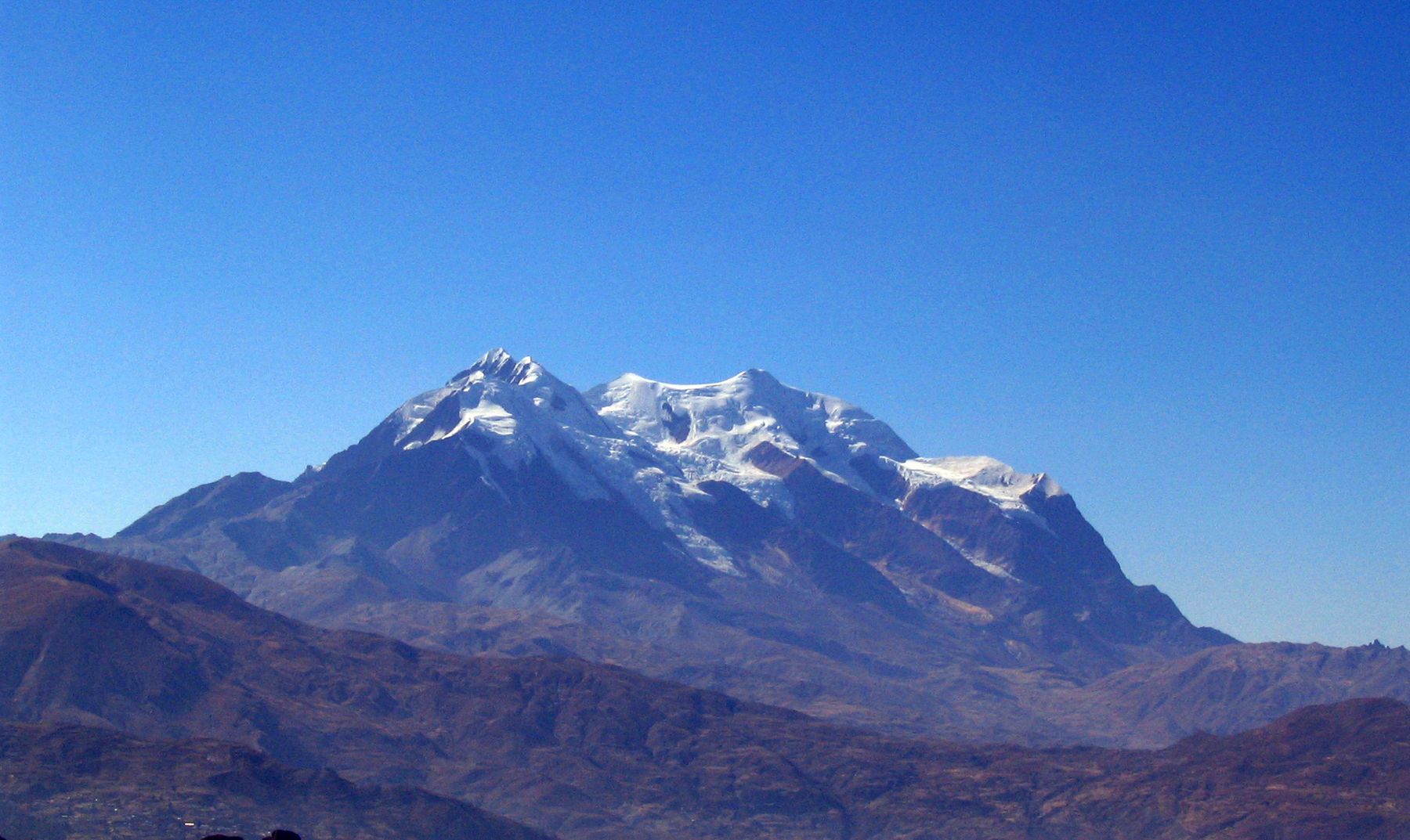
Look behind you as you rise. On a clear day Illimani fills the south-eastern sky, a mountain of several snow summits, about 6,400 metres high, that the city has treated as its guardian for as long as there has been a city. The ride is short and quiet, and it is the easiest climb of several hundred metres you will ever make.
El Alto, top of the Red Line
At the top you step out on the rim, above 4,000 metres. El Alto has grown into a city of its own, larger than La Paz by some counts, and much of it is Aymara. The air is noticeably thinner and colder, and the wind comes straight across the plain. Here you feel the altitude even after a few days in La Paz: walk slowly, do not run for anything, and keep this part of the day short if your head starts to ache.
On set days of the week a vast street market spreads across this part of El Alto, selling everything from car parts to clothes. Even without it, the view back down into the canyon is the point. Walk a short way along the edge to look over La Paz, then ride down again; the lines connect, so you can return by another colour and see a different slice of the city on the way.
Mirador Killi Killi
Late in the afternoon, take a taxi to Mirador Killi Killi, a small hilltop viewpoint on the east side of the centre. It is the place to see La Paz whole: the bowl, the brick climbing every slope, the Prado as a line of trees, the cable-car lines crossing it, and the dark rim of El Alto above.
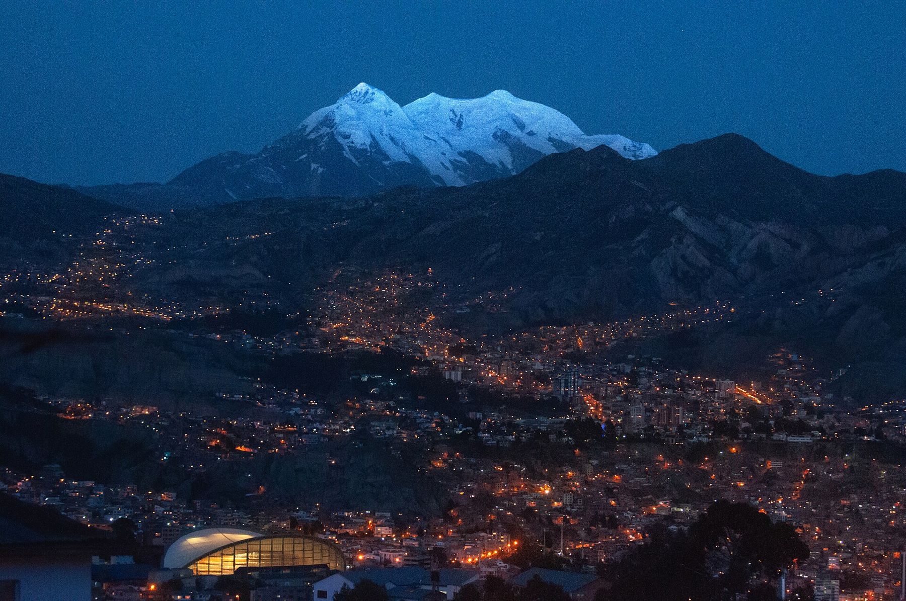
Stay as the light goes. The lights come on from the bottom of the canyon upwards until the walls are covered in them, and if the evening is clear, Illimani keeps a last pink glow long after the city is dark. It gets cold very quickly once the sun drops, so bring a warm layer and a hat, and take a taxi back rather than walking unfamiliar streets at night.
After the walk
La Paz is a city to give time to. A day of this walk is plenty at this altitude, and the evening is better spent sitting down with hot food and a lot of water than out late. If headaches, nausea or breathlessness get worse rather than better, rest, do not climb higher, and go down or see a doctor; the guide to altitude sickness explains the warning signs in plain terms.
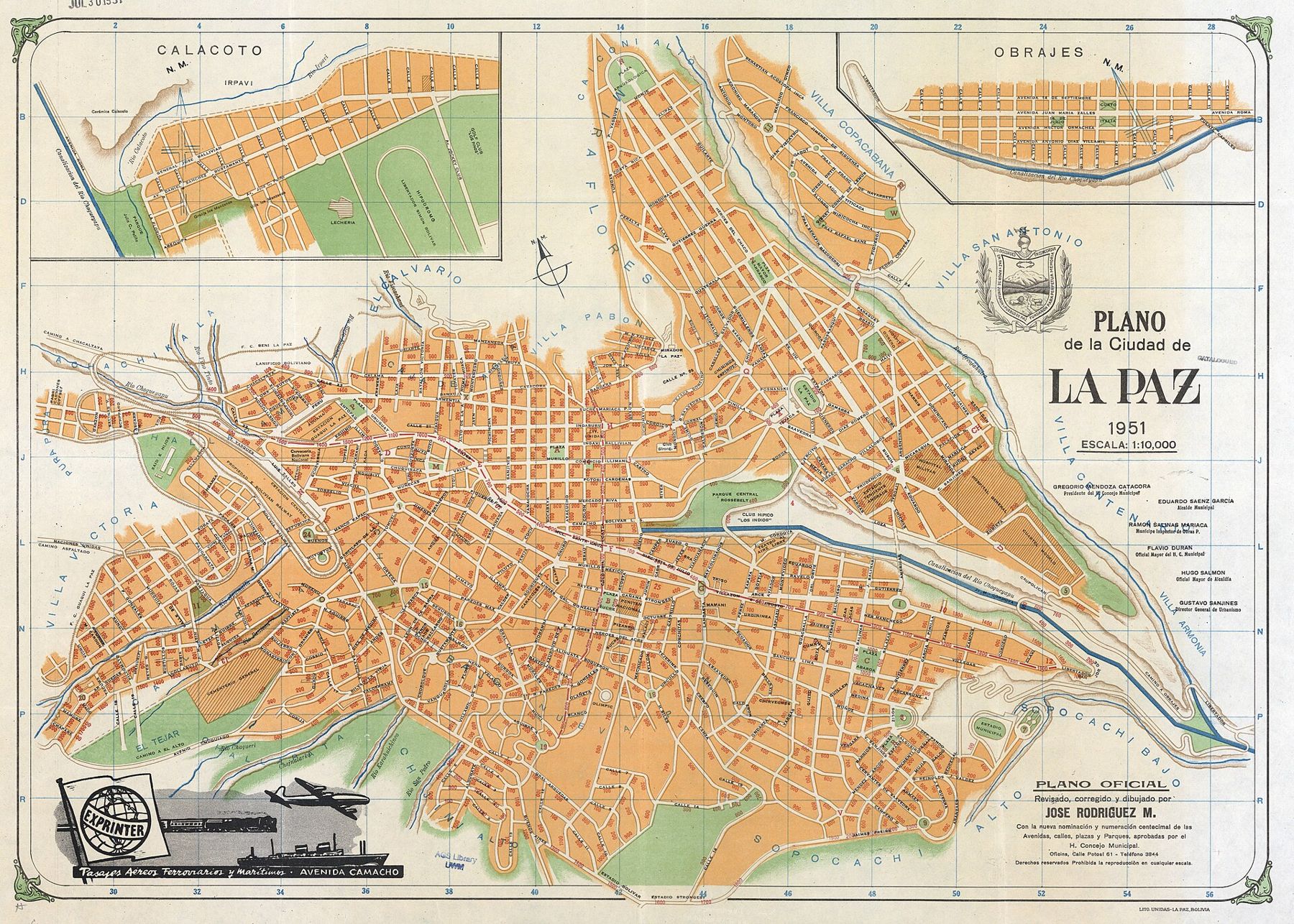
From here the routes run in every direction and every height. North-west, the road crosses the altiplano to Lake Titicaca, a little higher and a great deal calmer. South, the buses drop to Sucre, the white constitutional capital several hundred metres lower, where the air feels generous after this. Or go further up and further out, to the salt and the lagoons of the far south-west. Whichever way you go, the last thing you see as the plane or bus climbs out is the canyon itself, full of brick, with Illimani standing over it.