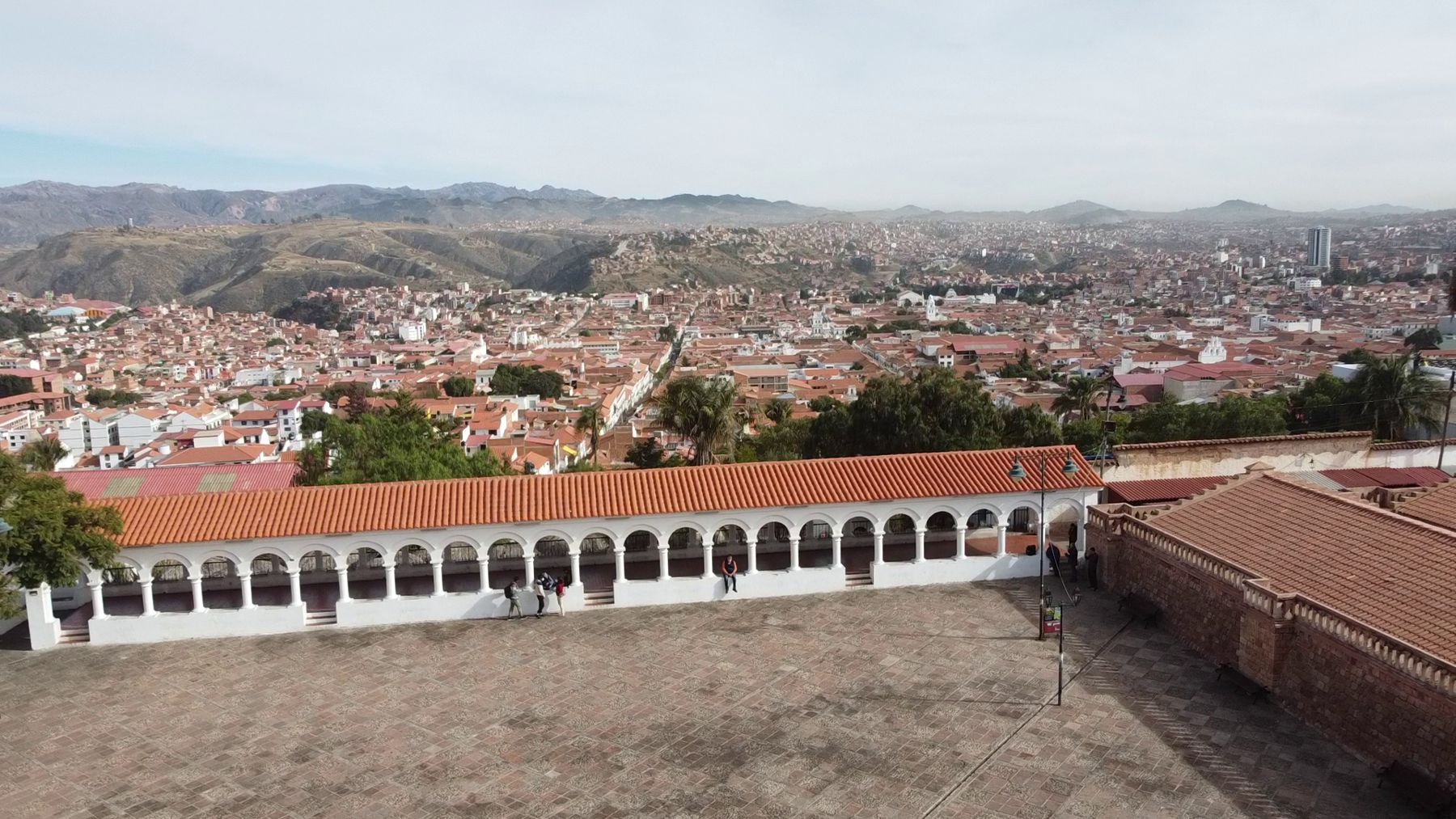
Sucre lies in a green valley in the southern Bolivian highlands, at 2,810 metres, surrounded by low, dry hills. Its old centre is a grid of whitewashed houses with tiled roofs, wooden balconies and shaded patios, churches with white towers, and streets of stone. By local rule and long habit, the buildings in the centre are kept white, and in the strong highland light the whole city shines.
Bolivia has two capitals. La Paz is the seat of government, where the president and the legislature sit. Sucre is the constitutional capital and the seat of the judiciary, home of the country's highest courts. The division dates from the end of the nineteenth century, when a short civil war moved the government to La Paz, and Sucre kept its title.
The city has had many names. The Spanish founded it in the 1530s as La Plata; it was also known as Charcas and Chuquisaca. It took its present name from Antonio José de Sucre, the independence general who became Bolivia's second president. UNESCO listed it in 1991.
At 2,810 metres, the air holds about 70 percent of the oxygen at sea level. If you come from the lowlands you will feel it on the first day, especially on the streets that climb toward La Recoleta. If you come down from Potosí or La Paz, much higher, Sucre will feel easy. Either way, take the first afternoon slowly, drink water and go to bed early. The climate is mild, with warm days, cool nights and a strong sun; wear a hat, and keep a jacket for the evening.
This walk covers the old centre on foot in half a day, about three kilometres, with a short climb to La Recoleta. The last stop, the dinosaur tracks, is a short ride north of the city.
Mercado Central
Begin a block north of the main square at the central market, a two-storey hall of stalls selling fruit, vegetables, meat, bread, flowers and herbs. Upstairs and in the corners, counters serve hot food and drinks. The fruit juice stands are the reason to come early: tall glasses of papaya, mango, strawberry or mixed fruit, blended with milk or water.
Sucre is also known for its salteñas, baked pastries filled with a juicy stew of meat, potatoes and peas. They are a mid-morning food in Bolivia, sold until they run out, and eating one without spilling the juice is a local skill.
Plaza 25 de Mayo
The main square is large and green, shaded by tall trees, with a statue of Sucre in the middle and benches all around. It is named for 25 May 1809, when the people of the city rose against the Spanish authorities in one of the first uprisings of the independence wars in South America.
Around the square stand the cathedral, the Casa de la Libertad, the old government buildings and colonial houses with balconies. In the mornings, people read newspapers, shine shoes and sell ice cream. In the evenings, families and students fill the benches.
Casa de la Libertad
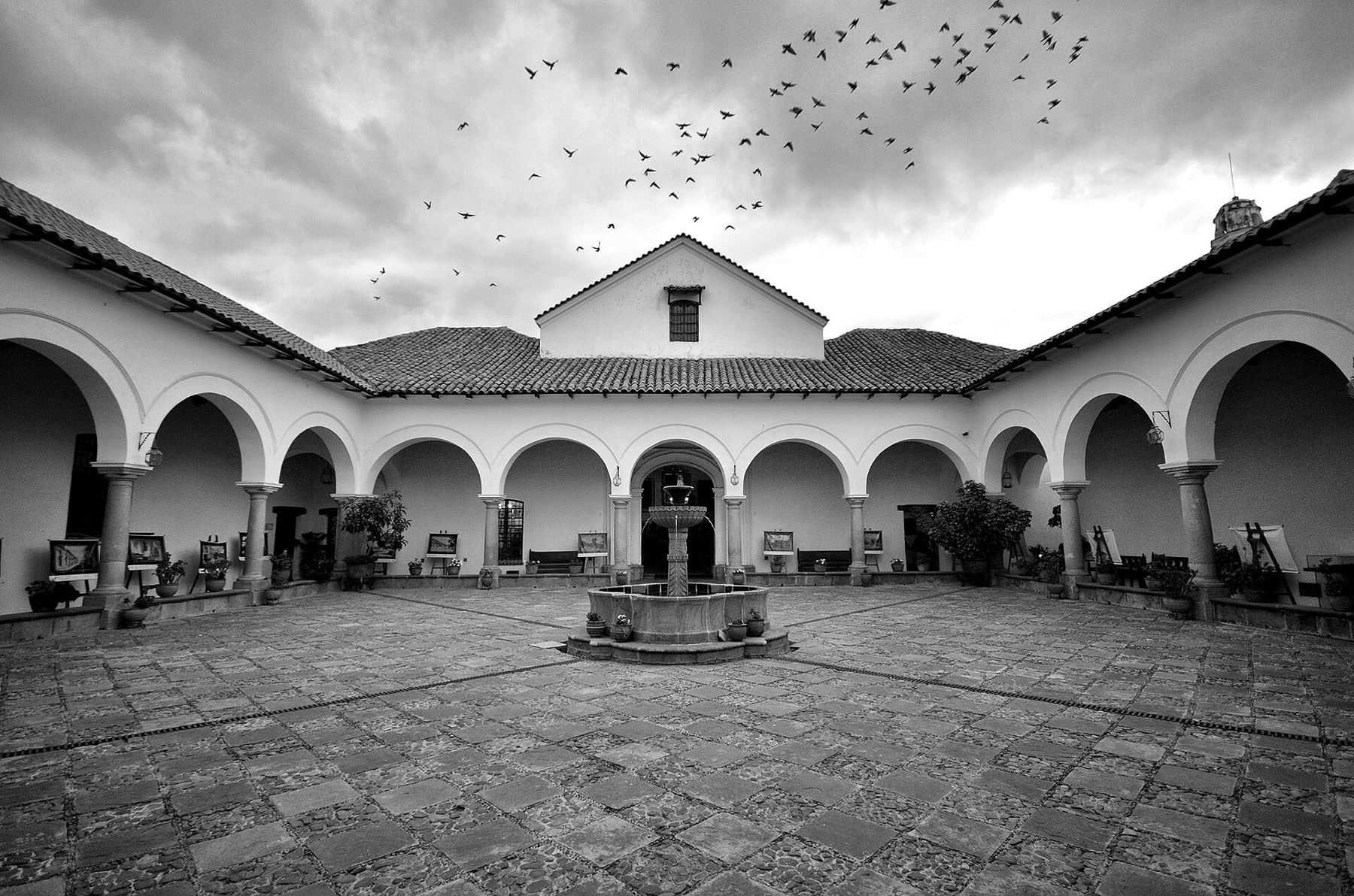
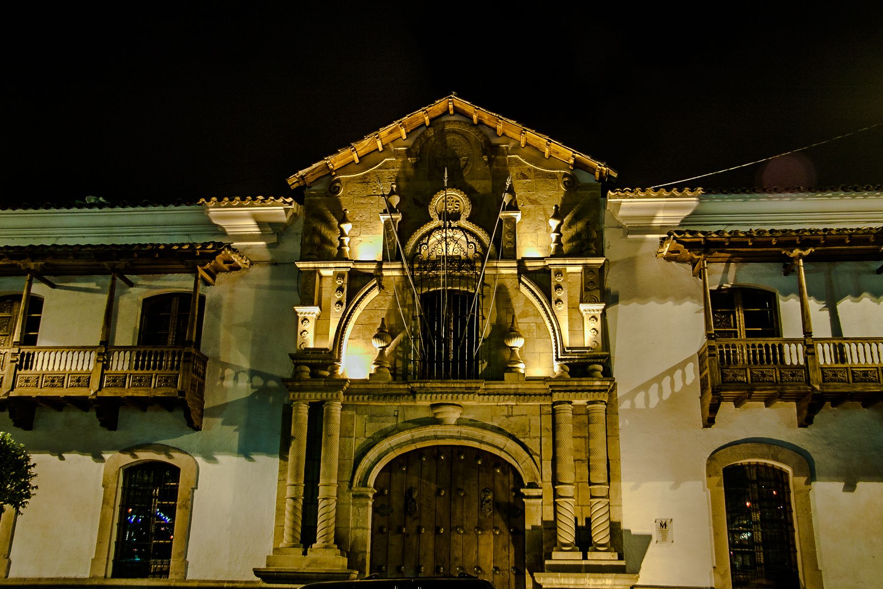
On the square stands the Casa de la Libertad, the House of Freedom, a colonial building that once belonged to the Jesuits and later to the university. On 6 August 1825, in its great hall, delegates signed the declaration of independence that created the new republic, named Bolivia after Simón Bolívar.
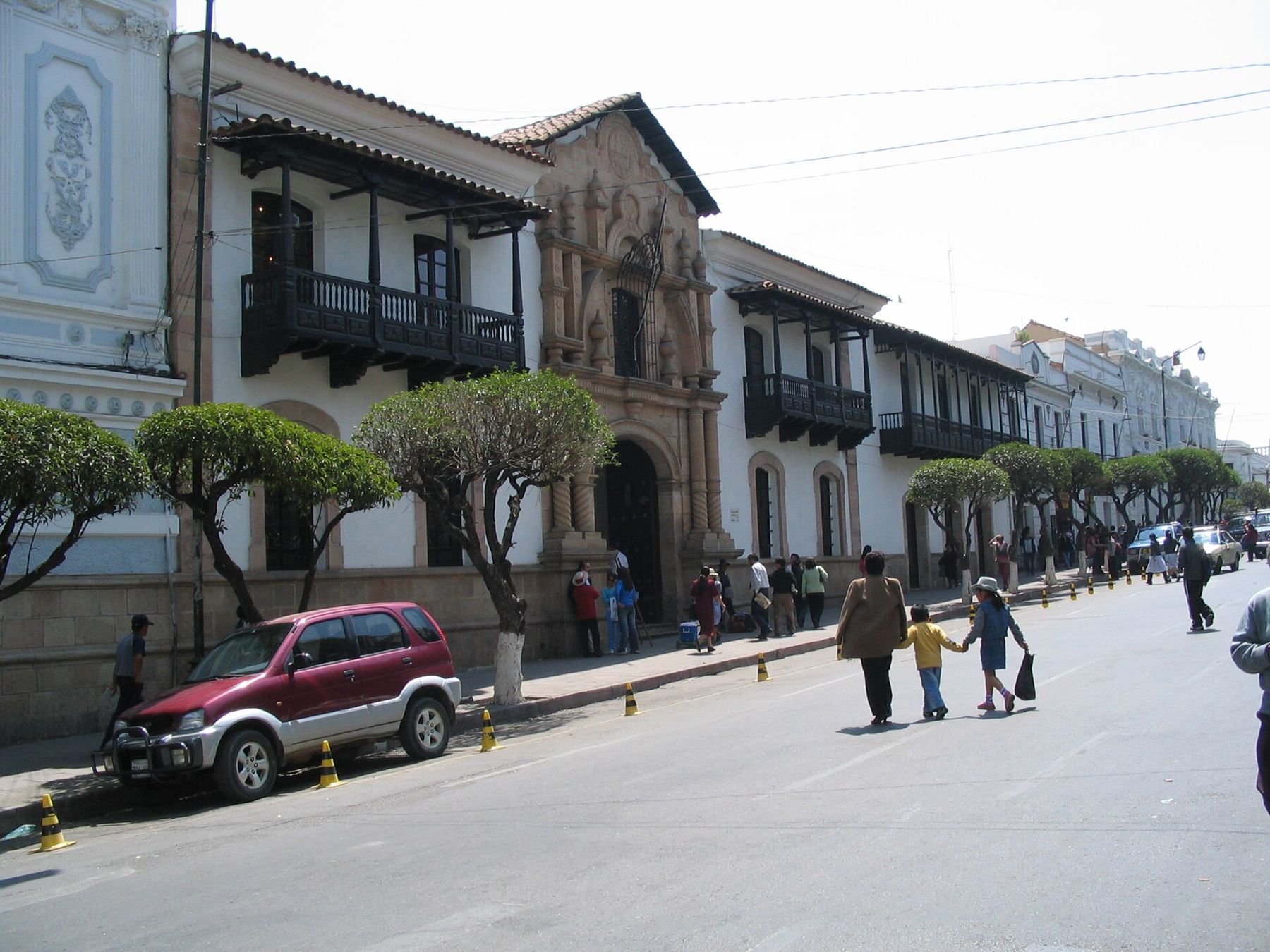
Today the building is a museum of Bolivian independence. The hall where the declaration was signed has wooden benches, portraits of the heroes of the independence wars and a carved and gilded ceiling. Around the patio, the rooms hold documents, paintings and flags. It is a modest building for so large a story, and all the more moving for that.
Catedral Metropolitana
Beside the square stands the cathedral, built mainly in the sixteenth and seventeenth centuries, with a tall white bell tower. Its museum holds silver, paintings and vestments from the colonial period, when the city was one of the richest in the Spanish empire, thanks to the silver mines of Potosí not far away.
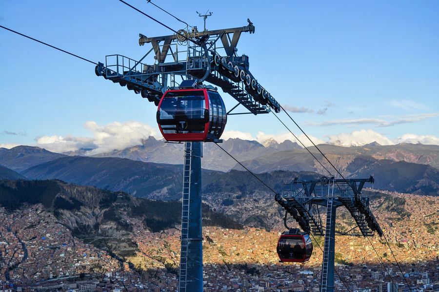 3,640 mLa Paz, the city that rides the air
Sucre was also a city of learning. Its university, founded in the early seventeenth century, is one of the oldest in the Americas, and its students played a part in the ideas that led to independence.
San Felipe Neri
A block southwest of the square stands the convent of San Felipe Neri, with white cloisters around a courtyard and a church with two towers. The building is used as a school, but visitors can usually go up onto the roof.
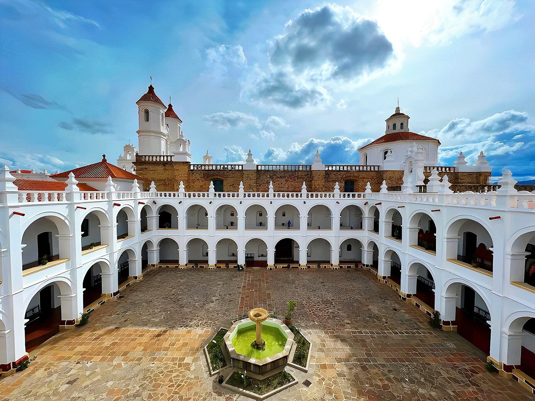
The roof terraces are the highlight: stairs and walkways between domes and bell towers, with views across a sea of red tile roofs and white walls to the hills around the valley. The stairs are steep; take them slowly at this altitude.
La Recoleta
From the centre, walk southeast up the sloping streets to a small square at the top of the hill. The climb is gentle but steady, and the air at this height makes it feel longer than it is. Stop halfway; you will be glad of it.
At the top stands La Recoleta, a Franciscan convent founded in the early seventeenth century, with quiet cloisters and gardens. Facing it, a long white arcade forms a viewpoint, the Mirador de La Recoleta, with a view across the whole city: the white towers, the red roofs, and the hills beyond. In the late afternoon the white walls turn gold, and cafés along the arcade put out their tables.
Cal Orck'o
A short ride north of the city, in a limestone quarry, is one of the most remarkable fossil sites in South America. Cal Orck'o is a vast wall of grey rock, nearly vertical, covered with thousands of dinosaur footprints. Around 68 million years ago, in the late Cretaceous, the wall was the muddy shore of a lake, and many kinds of dinosaurs walked across it. Over time the layers hardened into rock, and the movement of the Andes tilted them upward until they stood almost on end.
The quarry is still used, and the wall is protected and studied. A park beside it, the Parque Cretácico, has a viewing platform, an exhibition and life-size models of dinosaurs. Guided walks closer to the wall run on some days; check when you go. Bring a hat; there is little shade, and the sun is strong.
After the walk
Sucre is a city for staying a few days, for its calm, its mild weather and its food. It is also a good base for the Sunday market at Tarabuco, a highland town southeast of the city, where people of the area come to trade and many still wear their own distinctive dress.
From Sucre, the route climbs. The road southwest rises to the silver city of Potosí, above 4,000 metres, and on to the salt flat of Uyuni on the Altiplano. To the northwest lies the other capital, La Paz, more than 800 metres higher. To the south, the road leads down to the Argentine border, and from there through the Quebrada de Humahuaca to Salta and the red gorges. Before going higher, read our plain guide to altitude sickness. And before you leave Sucre, go back up to La Recoleta at sunset, and watch the white city turn pink, then blue, then dark.