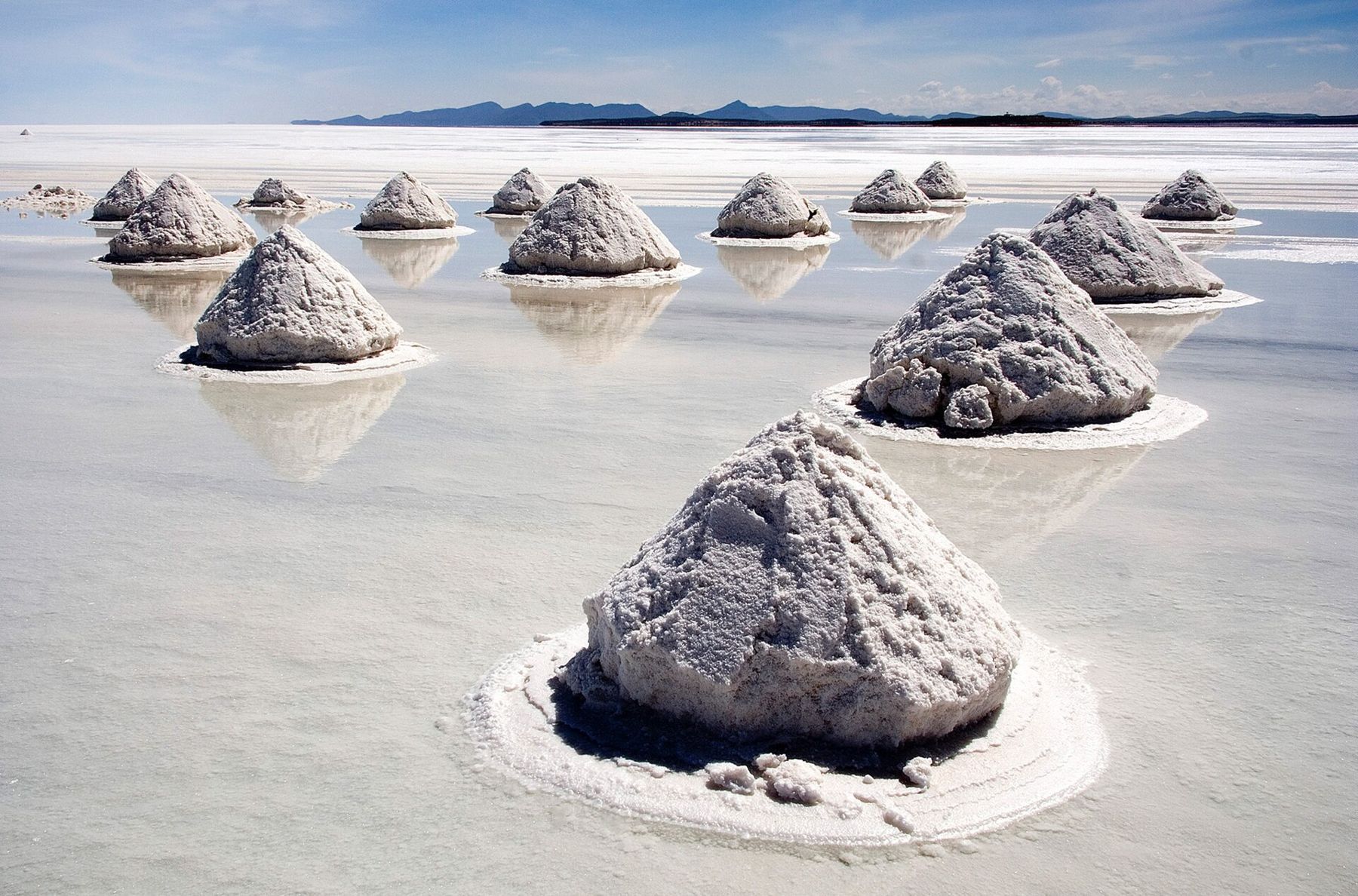
The Salar de Uyuni is the largest salt flat in the world, more than 10,000 square kilometres of white crust laid over brine at the bottom of a long-dried lake. It lies at about 3,650 metres in the south-west of Bolivia, and it is so flat that it is used to calibrate satellites. Standing in the middle, you lose all sense of distance: a car a kilometre away looks like a toy at your feet, and the mountains on the horizon float on a line of glare.
Most people see it on a three-day trip by four-wheel drive that crosses the salt and then heads south through the high desert of the Eduardo Avaroa Andean Fauna National Reserve, where the road climbs above 4,500 metres. It is one of the great journeys of the continent, and one of the hardest on the body. Days are dazzling and dry. Nights are bitterly cold, often well below freezing, in simple shelters without heating. The altitude is constant and gets higher each day.
So arrive prepared. Two or three days at altitude beforehand, in La Paz, Potosí or Sucre, are not a luxury here. Pack a proper down jacket or several warm layers, a hat, gloves, a sleeping bag if you have one, sunglasses that block glare from the sides, high-factor sun cream and lip balm. Carry more water than you think you need: the dry air takes it from you with every breath.
Uyuni and the train cemetery
The town of Uyuni is a grid of low buildings and wide windy streets on the plain, and it exists because of the railway. In the late nineteenth and early twentieth centuries, lines were built through here to carry minerals from the mines towards the Pacific ports. When the mining declined, the locomotives were left to rust on the edge of town.
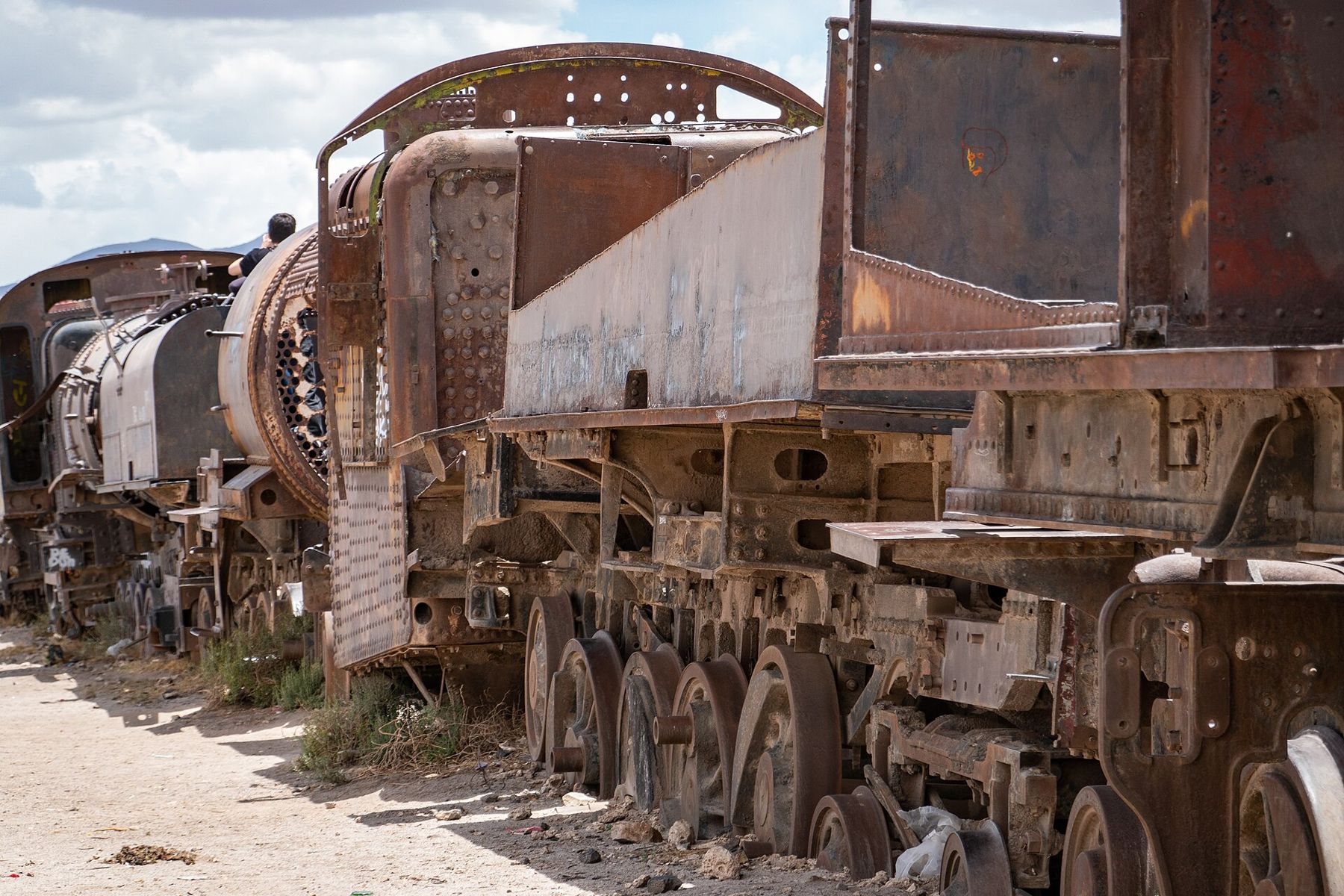
The train cemetery is the usual first stop: rows of steam engines and wagons, rusted to a deep orange, standing in the dust a short way outside town. Wind whistles through the boilers. Then the road heads to Colchani at the edge of the salt, where families cut, dry and pack salt by hand and the conical piles of raked salt stand in rows on the flat.
Out on the salt
The salt flat is crusted in hexagons, ridged polygons that cover the ground in every direction to the horizon. In the dry months, from about May to October, it is hard and white, and the light is so intense that sunglasses are essential and photographs come out with no shadows at all. People spend hours playing with perspective: tiny people standing on giant boots, friends held in a palm.
In the wet months, roughly January to March, a thin layer of water lies on parts of the salt and the flat becomes a mirror. Sky and ground merge; clouds pass under your feet. It is the image that made the salar famous, but it comes at a price. Some routes become impassable and trips may be shortened or changed, so choose your season for what you most want to see.
Under the crust lies one of the largest lithium reserves known, and its future is a matter of national debate in Bolivia. You will see little of that, only the salt, a few vehicles and the hum of wind across nothing.
Incahuasi island
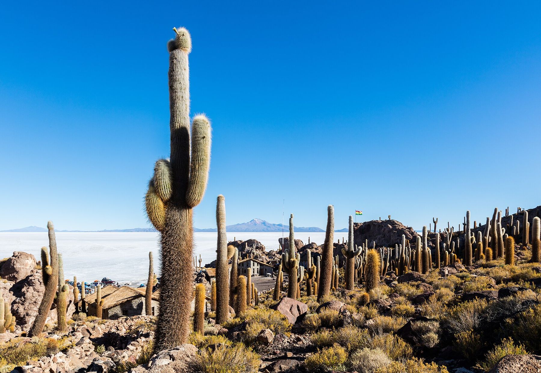
Far out on the flat, Incahuasi rises from the white like a ship. It is a hill of rock and fossilised coral-like formations left by the ancient lake, and it is covered in giant columnar cacti, many far taller than a person, that grow only a few centimetres a year.
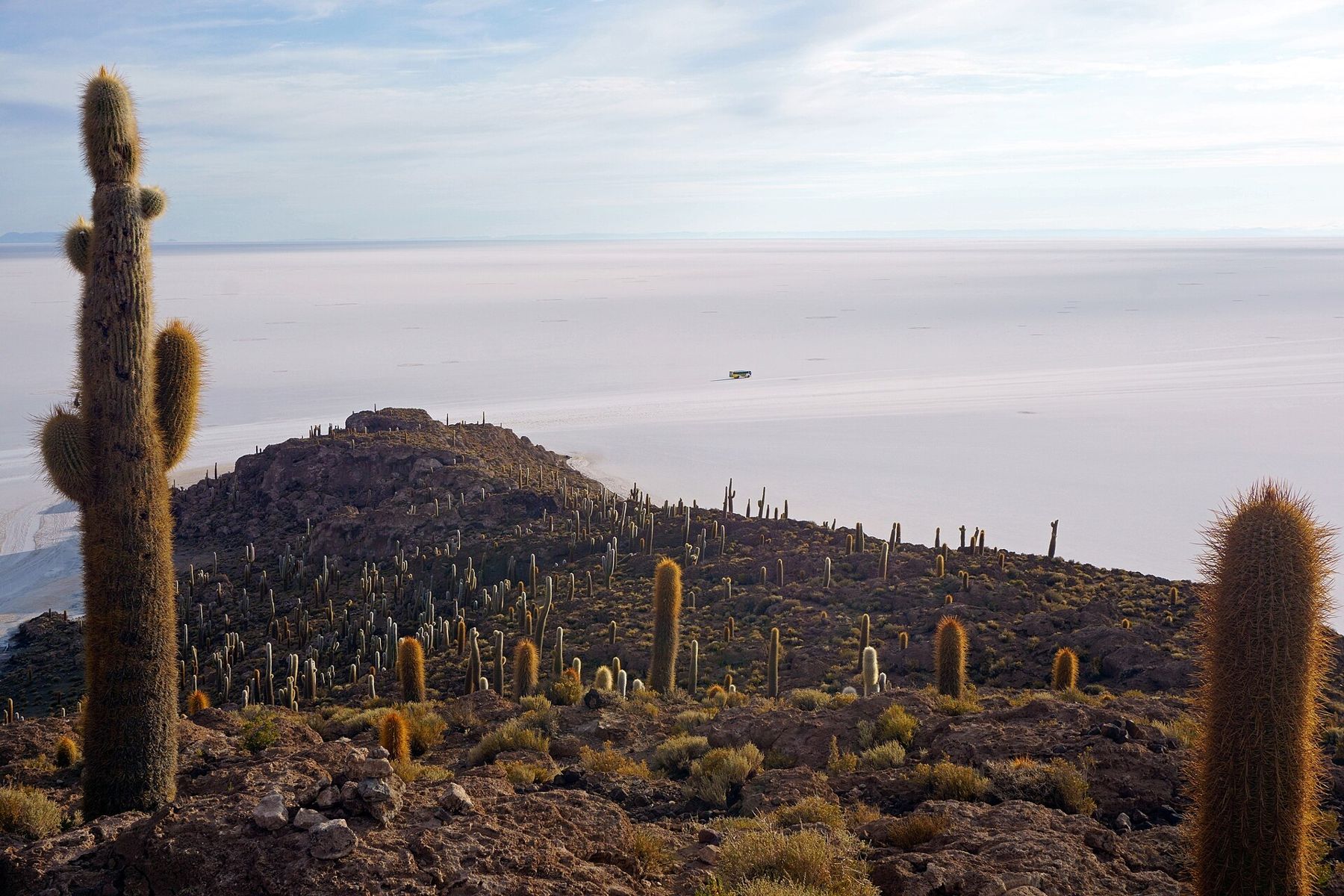
A path climbs to the top, and it is a short climb that will leave you breathless. Take it slowly; there is no hurry, because the view from the summit is the same for an hour. From up there, the salt stretches in every direction, the shadows of the cacti reach across the rock, and the vehicles parked below look like insects. 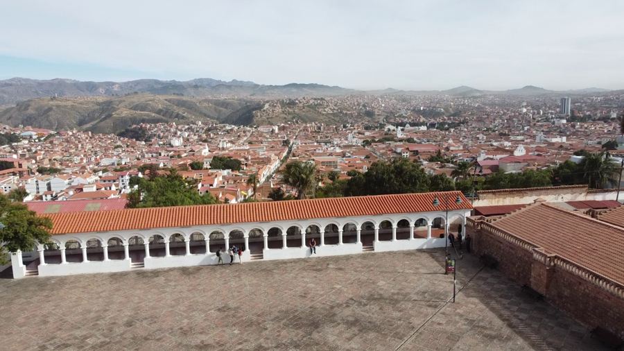 2,810 mSucre, the white capital of Bolivia The island has a small entry fee collected locally. Pay it, take your rubbish with you and stay on the paths: the cacti are slow-growing and old.
The volcanoes and Laguna Colorada
On the second day the trip leaves the salt and climbs south into a landscape of volcanoes, red and ochre hills and lagoons tinted by minerals and algae. There are rock formations sculpted by wind, including the much-photographed Árbol de Piedra, a stone tree standing alone on the sand. The road climbs higher and higher, and the air thins with it.
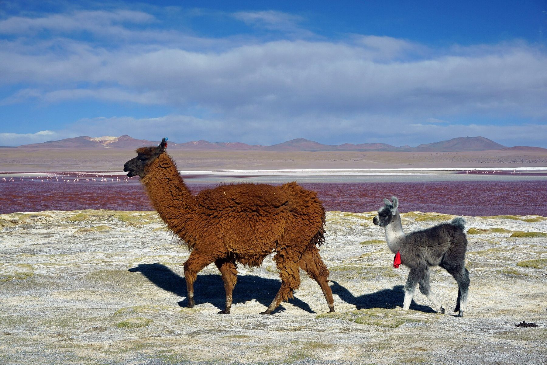
Laguna Colorada is the highlight: a shallow lake that turns red, rust or pink depending on light and wind, with white borax islands and hundreds of flamingos feeding in the water. Llamas and vicuñas graze on the shores. The wind here can be ferocious by afternoon, and it carries a cold that goes through ordinary jackets. Most groups spend the second night nearby, at well over 4,000 metres. Expect to sleep badly at this height, wake with a dry throat, and feel the cold through the walls.
Geysers, hot springs and Laguna Verde
The third day starts before dawn, in darkness and deep cold, to reach the geyser field known as Sol de Mañana at first light, when the steam is most visible. Mud pools bubble and vents roar at an altitude near 5,000 metres. Keep well back from the edges of pools and stay on firm ground; the crust can be thin.
After the geysers come hot springs at the edge of a lagoon, where bathing in warm water while the air is below freezing is one of the trip's oddest pleasures. Then the road reaches Laguna Verde, a mineral lake that turns green when the wind stirs it, under the perfect cone of Licancabur volcano on the Chilean border. Park fees for the reserve are collected on the way; rules and amounts change, so carry some cash.
Altitude, cold and the way out
This is the trip on which altitude sickness most often catches people out, because the sleeping height rises each night and there is no easy way down in the middle of the desert. Headaches and poor sleep are common. If symptoms worsen, especially confusion, severe breathlessness at rest or an inability to walk straight, tell your driver at once and descend. Speak to a doctor about medication before you travel, and read the guide to altitude sickness before you go.
On the third afternoon, most trips either loop back to Uyuni or drop passengers at the Chilean border, from where the road falls fast to San Pedro de Atacama and the start of El Tatio and the Atacama, on the other side of the same volcanic chain. Heading the other way, the long road north goes back to La Paz. For warm clothes and sun gear, the packing guide covers what this cold, high desert demands.
Whichever way you leave, look back once from the last rise. The salt lies behind you as a white line under the mountains, too bright to look at for long.