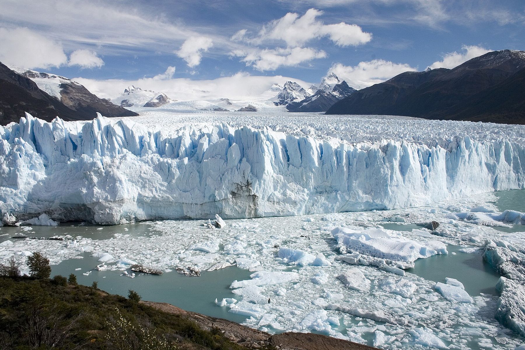
The Perito Moreno glacier is in Los Glaciares National Park in Argentine Patagonia, about 80 kilometres by road from the town of El Calafate. It is one of the few great glaciers in the world that you can stand in front of without a boat, a climb or a long hike. A peninsula reaches out almost to its face, and from the walkways on that peninsula you look across a narrow channel of grey-green water at a wall of ice about five kilometres wide and, on average, around seventy metres above the water.
There is no altitude to worry about. The glacier front is at about 200 metres. What replaces altitude here is the cold that comes off the ice, the wind that comes off the ice field, and the light. The air at the glacier is noticeably colder than in El Calafate, even in summer. The wind can be strong and gusty. The sun, reflecting from water and ice, burns quickly in the clean, dry air. Dress in layers, bring a windproof jacket, a hat and gloves, and wear sunglasses and sun cream.
El Calafate
El Calafate sits on the southern shore of Lago Argentino, the largest lake wholly within Argentina, its milky turquoise water coloured by the fine rock flour that glaciers grind and wash into it. The town has grown fast with tourism and is mostly new, low and built along one main avenue, with the steppe and a flat-topped hill behind it. It takes its name from the calafate, a thorny shrub with dark blue berries; a local saying holds that whoever eats the berry will return to Patagonia.
The town is the base for the glacier and for the rest of the park. At its edge, a lakeside wetland reserve attracts flamingos, swans and other water birds. A large museum about glaciers and ice, on the road out of town, is a good introduction before you see the real thing. And the wind is a fixture: by afternoon it often churns the lake into whitecaps.
The road to the ice
The road from El Calafate follows the shore of Lago Argentino west and then turns into the hills, leaving the dry steppe for forest of southern beech. At the park entrance, fees are charged; the rules and amounts change, so check before you go. Then the road winds along the shore of the lake's southern arm, and, at a bend, the glacier appears for the first time, a white tongue pouring down from the mountains between dark forested hills.
The glacier takes its name from Francisco Pascasio Moreno, a nineteenth-century Argentine explorer and naturalist. He was known as the Perito, the expert, for his work as Argentina's specialist in the long boundary dispute with Chile over these mountains. The land he gave to the nation further north became the first of Argentina's national parks, around Nahuel Huapi.
The Perito Moreno is one of the outlet glaciers of the Southern Patagonian Ice Field, a vast sheet of ice that runs for hundreds of kilometres along the Andes between Argentina and Chile. It is the largest expanse of ice in the southern hemisphere outside Antarctica, and it feeds dozens of glaciers on both sides of the border. The Perito Moreno itself is about 30 kilometres long.  15 mUshuaia, where the road runs out
The walkways
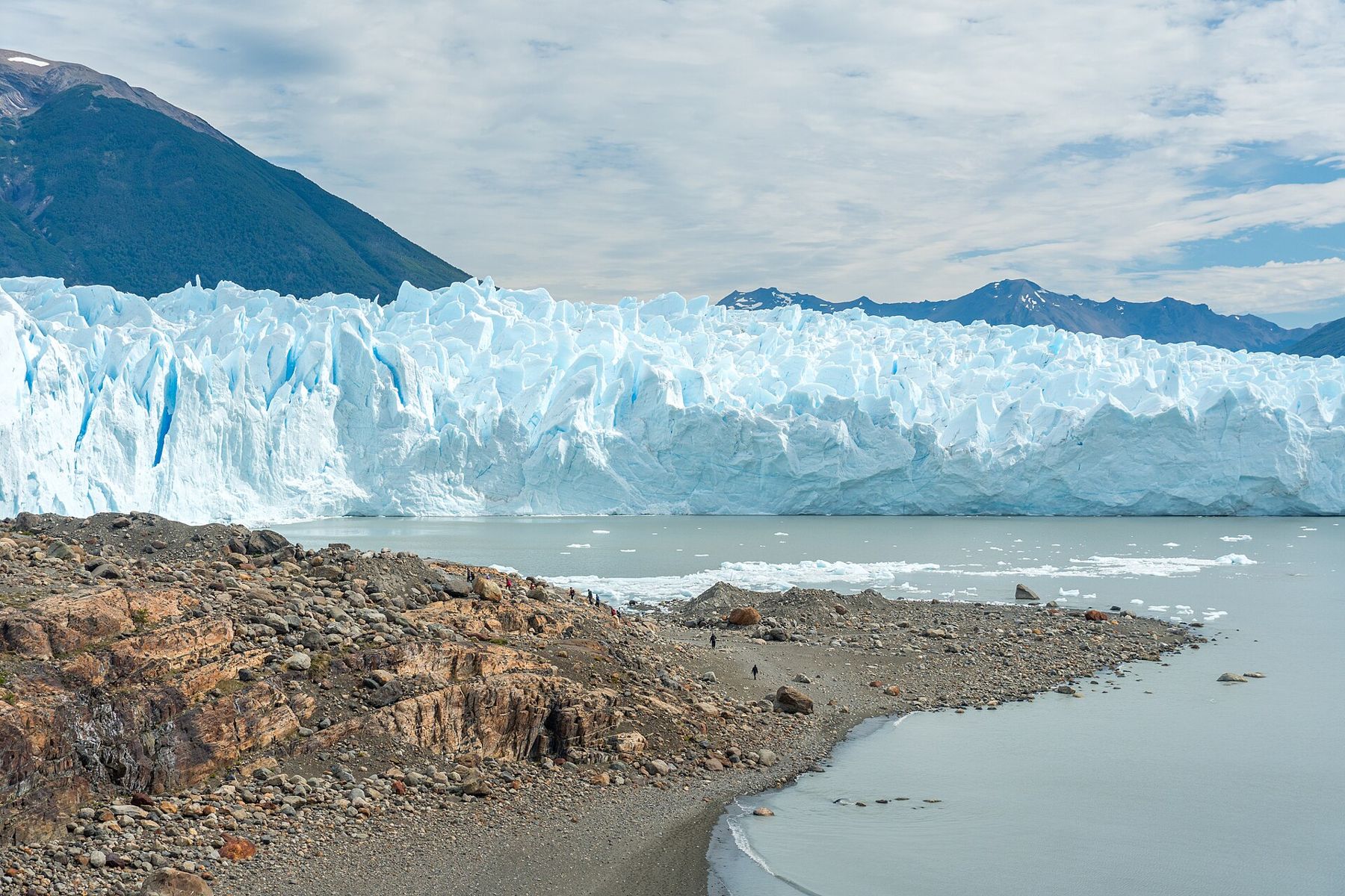
The walkways, a network of metal stairs and balconies on the Magallanes peninsula, lead down from the car park to platforms that face the glacier from several angles and heights. There are several colour-coded circuits; you can walk them all in a couple of hours or spend a whole day. The closest platforms are only a few hundred metres from the ice face.
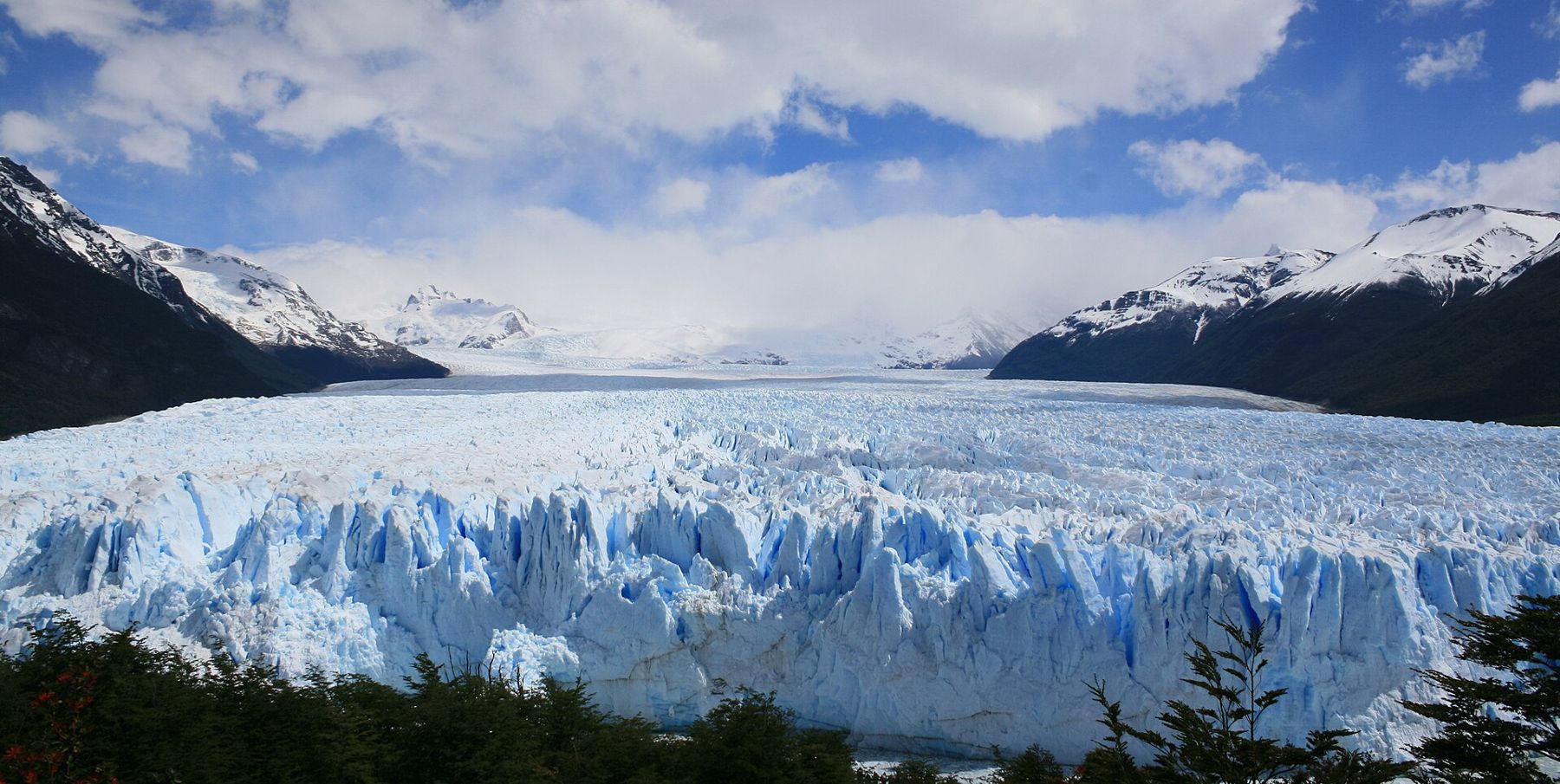
The face of the glacier is not smooth. It is a jumble of towers, pinnacles and crevasses, white on top and deep blue in the cracks, where the ice is compressed and dense. The blue is strongest on overcast days, when the light is soft and the shadows deep. On sunny days, the surface glitters and the blue is paler.
And the glacier is moving. It advances towards the peninsula by roughly two metres a day in the centre, and as it does, the front breaks off. Listen as you walk: there are constant cracks, groans and rumbles from inside the ice, like distant thunder. Every so often, a piece of the face breaks away and falls into the water with a roar, sending up a column of spray and a wave across the channel. Small pieces fall often. Large ones, the size of a building, fall less often, and you may wait hours for one.
Every so often, a piece of the face breaks away and falls into the water with a roar, sending up a column of spray and a wave across the channel.
Stay on the walkways. In the past, people who went down to the shore were killed by flying ice and by the waves that calving sends across the channel. Today the platforms keep visitors at a safe distance.
The ice dam and its ruptures
The Perito Moreno is famous for one unusual behaviour. As the glacier advances, it sometimes reaches the shore of the peninsula, forming a dam of ice that cuts off the southern arm of the lake, the Brazo Rico, from the rest of Lago Argentino. Water builds up behind the dam, and the level in the Brazo Rico can rise by many metres above the main lake.
Eventually, the pressure of the water carves a tunnel under the dam, which widens into an arch of ice. Then the arch collapses, often over hours or days, sometimes at night, and the water rushes out into the main lake. These ruptures happen irregularly, sometimes several years apart, sometimes in successive years, and each one draws crowds to the walkways and attention across Argentina.
The glacier is also unusual for another reason. For many decades, while most of the world's glaciers retreated, the Perito Moreno appeared stable, gaining roughly as much ice as it lost. Recent measurements suggest that it has begun to thin and pull back, as the rest of the ice field has done. Whether that is a long-term change is still being studied.
On the ice and on the water
Boats leave from a small port near the walkways and cruise along the face of the glacier, giving a sense of its height that the platforms cannot. From the water, the face looms over you like a cliff, and the cold comes off it in waves.
Guided walks on the glacier itself, with crampons, are run under a park concession on the southern side. They cross the ice among crevasses and pools of meltwater, an extraordinary experience of a different scale. Age and fitness limits apply, and the details change, so check before you book. Never walk on the ice without a guide.
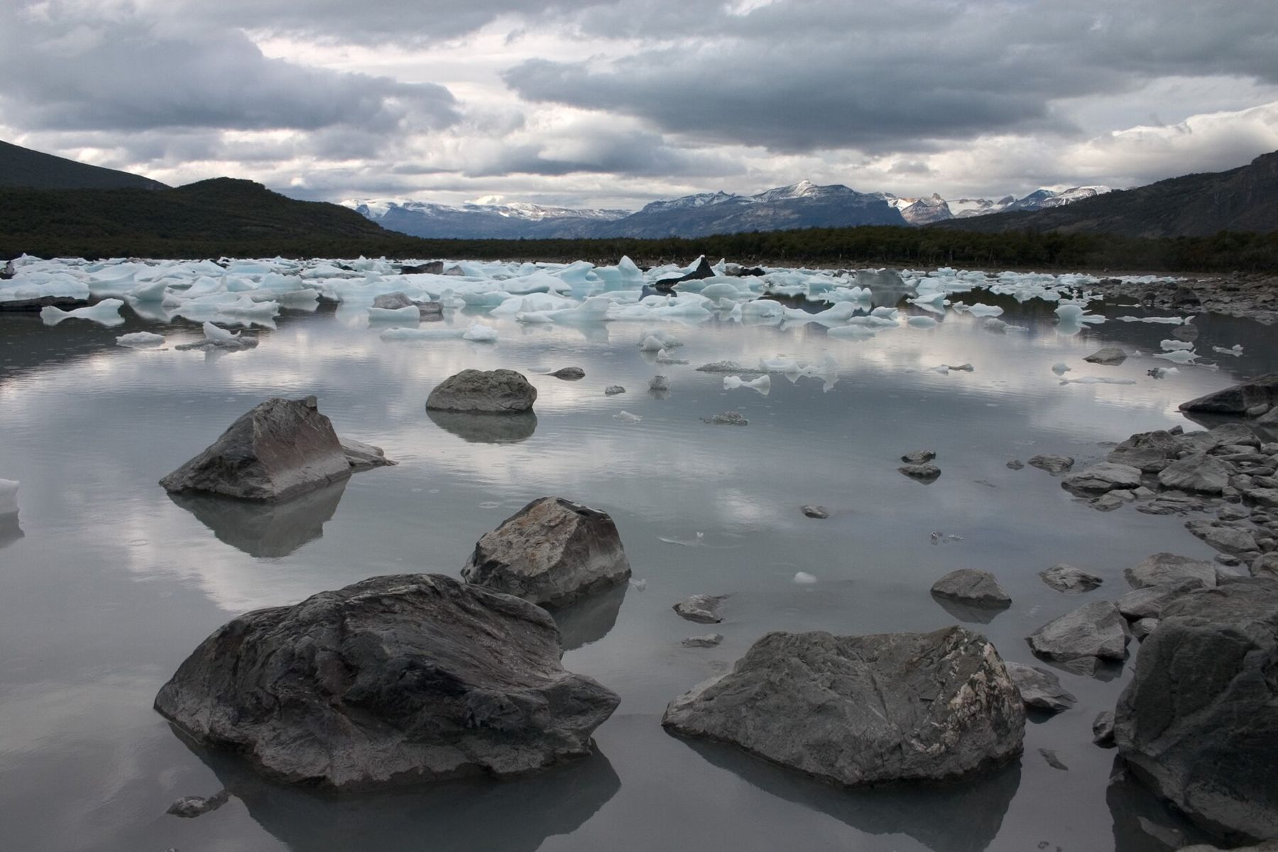
Other boat trips from El Calafate run across Lago Argentino to the park's other glaciers, larger and more remote, past icebergs drifting in the lake.
When to go and onward
The glacier is open all year. The main season runs from about November to March, when days are long and the weather is mildest, though it is never warm at the ice. Autumn brings colder days and red forest; winter is cold, quiet and short of daylight, but the glacier is still there, and the walkways are almost empty. In every season, bring warm layers, waterproofs and sun protection.
From El Calafate, the road runs north across the steppe to El Chaltén and the granite of Fitz Roy, and south across the border into Chile to Torres del Paine. The guide to getting around covers the long distances of Patagonia.
Before you leave, stand at the lowest platform and wait. Listen to the ice. After a while, you hear the glacier the way you hear a river, constantly, and then a crack louder than the others, and a tower of blue ice leans out and falls.