El Chaltén is a village at the northern end of Los Glaciares National Park in Argentine Patagonia, at about 400 metres above sea level, on a river plain under a wall of granite. It was founded in 1985, partly to settle Argentina's presence in a border area then disputed with Chile, and in a few decades it has grown from a handful of houses into the country's trekking capital. Its streets are lined with low, brightly painted buildings, wood stoves and rental shops for boots and poles, and its trails start where the streets end.
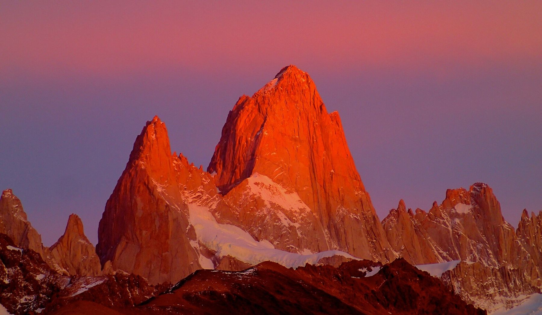
Above it rise Fitz Roy and Cerro Torre, two of the most famous mountains in the world among climbers. Fitz Roy, at roughly 3,400 metres, is a sheer granite tower flanked by smaller needles. Its local name, Chaltén, is often said to mean the smoking mountain, after the clouds that stream from its summit. Cerro Torre, a little lower and slimmer, is a needle capped with rime ice.
There is no altitude problem here. The village is low, and the trails stay well under 1,500 metres. What takes its place is weather. At about 49 degrees south, El Chaltén lies in the path of the westerlies blowing off the Southern Patagonian Ice Field, and the wind is the constant companion of every walk. Gusts can knock people off their feet. Clouds can hide the peaks for days, then lift in an hour. The trick here is to be in the right place when that hour comes.
Arriving and the visitor centre
The road from El Calafate crosses the steppe, an open land of yellow grass, guanacos and wind-bent fences, and runs along the shore of Lago Viedma, with glaciers visible on the far side. Then the mountains appear: on a clear day, Fitz Roy stands on the horizon long before the village.
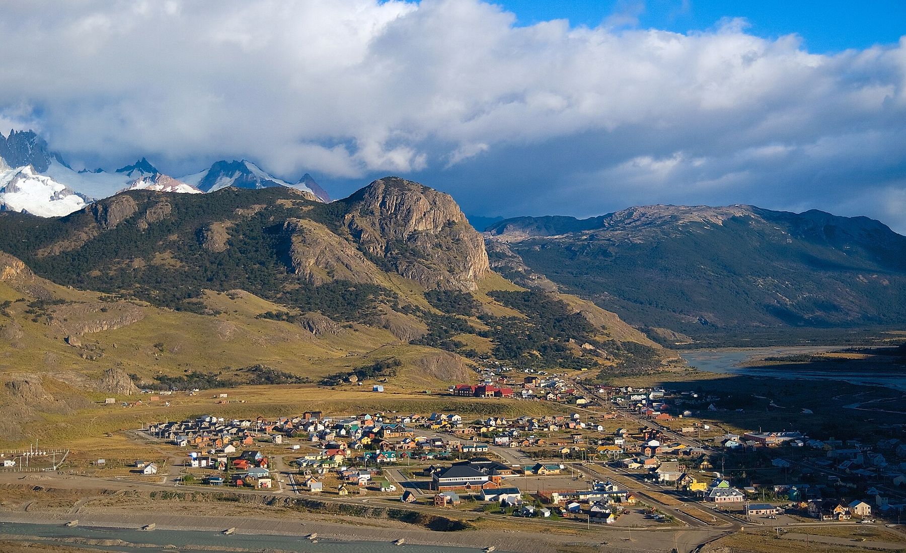
At the edge of the village, the national park visitor centre gives a short briefing on the trails, the weather and the rules. The rules matter. Camping is only allowed in designated sites, fires are not allowed, and you must carry out all your rubbish. Trail rules and fees change from season to season, so check what applies when you arrive. Many people start their visit with a short, steep walk to the viewpoint known as the Mirador de los Cóndores, above the village, for a first look at the whole massif.
Laguna Torre
The trail to Laguna Torre leaves from the western edge of the village and follows the valley of the Fitz Roy river. It is a walk of a few hours each way, mostly gentle, through southern beech forest and across open meadows, with a long view up the valley to the spires of Cerro Torre.
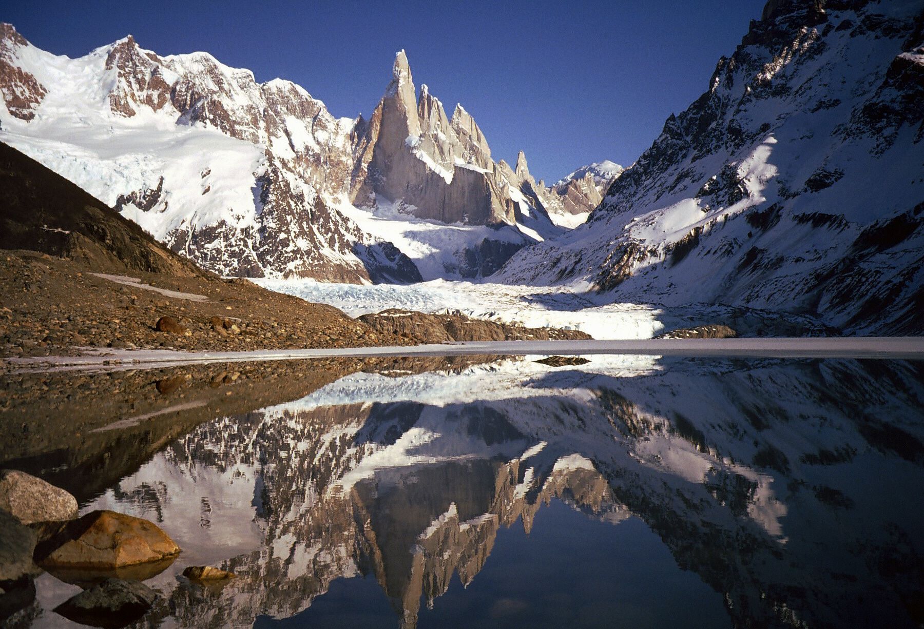
The lake at the end lies at the snout of a glacier, often with icebergs floating in its grey water, under Cerro Torre and the needles beside it. On a clear day the view is extraordinary; on a cloudy day you may see nothing but the bottom of the glacier. The wind funnels down the valley off the ice, and it is often far colder at the lake than in the village. Carry a warm layer and a windproof jacket even if you set out in sunshine.  893 mBariloche, where the lakes begin
Laguna de los Tres
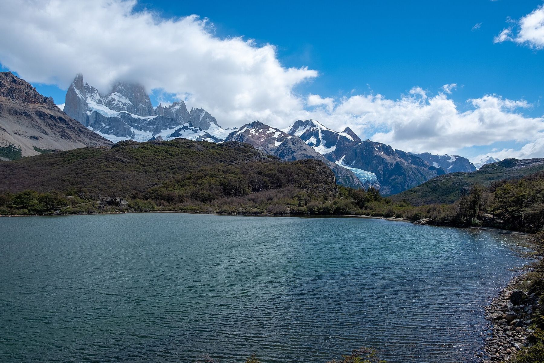
The classic walk from El Chaltén is to Laguna de los Tres, the glacial lake at the foot of Fitz Roy. It is a long day of about 20 kilometres return. The trail leaves from the northern end of the village and climbs gently through forest and across meadows, passing smaller lakes including Laguna Capri, with Fitz Roy reflected in its water on still mornings.
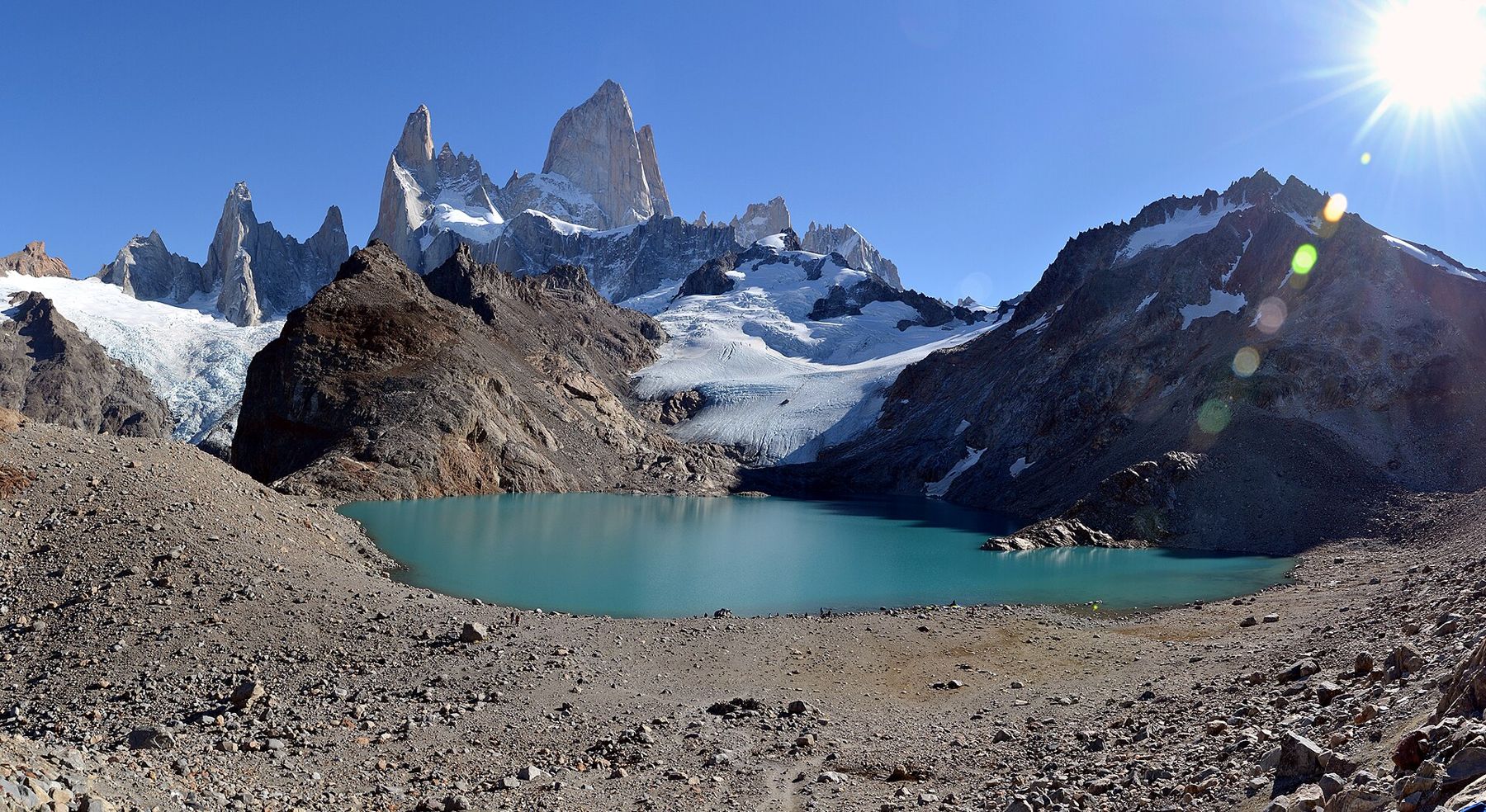
The last hour is the hard part: a steep, rocky climb of several hundred metres up the moraine to the lake. At the top, the effort is repaid. The lake lies in a hollow of rock and ice, and Fitz Roy rises straight from its far side, a sheer wall of granite. On a calm day the water is a turquoise mirror. On a windy one, gusts tear across the surface and drive spray into your face, and it is hard to stand at the edge.
Start early. The light is best in the morning, and the clouds often build through the day. Many walkers set out in the dark to see Fitz Roy turn red at sunrise. Carry water, food and warm layers, and turn back if the weather turns or if you are tired before the final climb.
Wind and weather windows
The Patagonian wind is the defining condition of El Chaltén. It can blow at well over 100 kilometres an hour in gusts, often for days at a time, and it comes in bursts without warning. On exposed ridges and lakeshores, it can push walkers off balance. Keep your pack tightly closed, hold on to your hat, and sit down if a gust catches you on rocky ground. A windproof jacket is the single most important thing in your bag.
The weather changes fast and constantly. Sun, rain, snow and wind can all arrive within an afternoon, even in summer. The peaks can be hidden for days at a time and then appear without warning, clear and close. Plan a spare day or two, check the forecast daily, and be ready to do the big walk on the first clear morning. The village's climbers live by these weather windows, and walkers would do well to copy them.
When to go and what to bring
The main season runs from about November to March. In December and January the days are very long, with around sixteen hours of daylight, so long walks can start early and end late. The weather is never reliably good, but it is warmer and the trails are clear of snow. Autumn, in April, brings red and gold beech forest and colder days. In winter, many services close and snow covers the higher trails.
Pack layers: a warm fleece, a windproof and waterproof jacket, a hat and gloves for the cold at the lakes, sunglasses and sun cream, because the southern sun is strong even when the air is cold. The packing guide covers the gear for Patagonia's mix of wind, rain and sun.
South from here
From El Chaltén the road runs back south to El Calafate and the Perito Moreno glacier, an easier day out where the ice comes to you. Across the border in Chile, a few hours further south, Torres del Paine has its own granite towers, its own wind and its own long trails.
On your last evening, walk to the edge of the village and look back up the valley. If the clouds have lifted, Fitz Roy stands over the roofs in the last light, red and enormous, a wisp of cloud blowing from its summit like smoke.