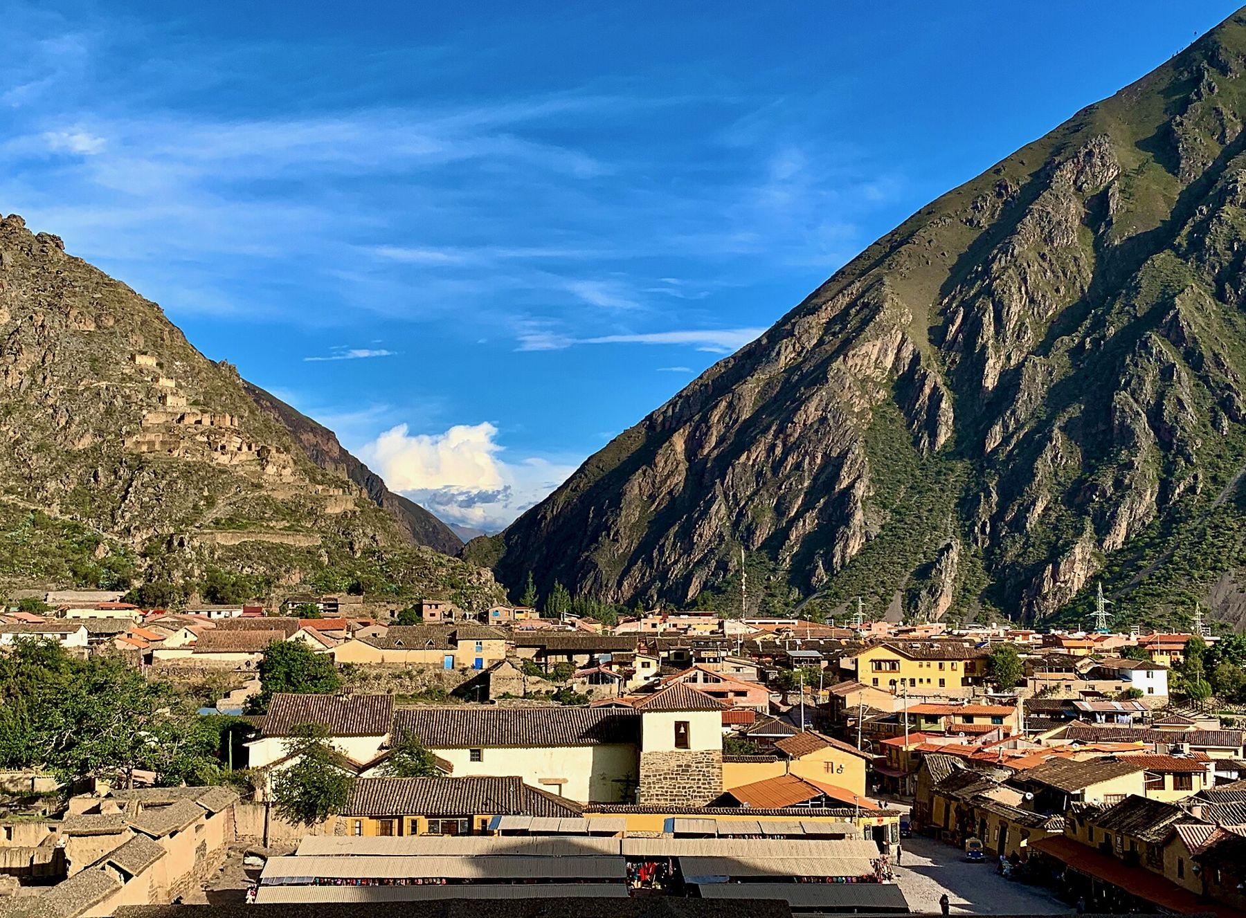
The Urubamba River runs northwest from the mountains below Cusco through a broad, fertile valley, before plunging into the gorge that leads to Machu Picchu. The stretch between Pisac and Ollantaytambo is known as the Sacred Valley. Its floor is green with maize fields, eucalyptus and willows, while the mountains on either side rise steeply to bare rock and, on the northern side, to snow-capped peaks.
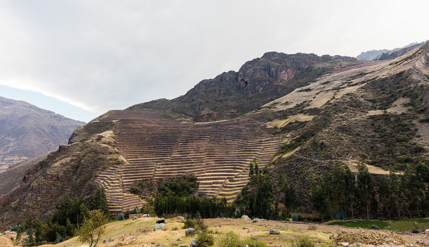
For the Inca, this was rich farmland, close to their capital. They built towns, temples and estates here, and terraced the mountainsides to grow maize and other crops. Many of those terraces are still farmed today, and the villages along the river keep a rhythm of fields, markets and festivals that has deep roots.
Lower, warmer, easier
The valley floor lies at around 2,800 to 3,000 metres, several hundred metres lower than Cusco. The difference is real. The air is a little thicker, the days are warmer, and nights, though cold, are milder than in the city. Many travellers come straight here from the airport in Cusco, spending their first nights in the valley before going up to the city. It is a sensible way to adjust.
But this is still high altitude. The air holds only about 70 percent of the oxygen at sea level, and the ruins on the slopes above the valley are higher still. Climbing the terraces at Pisac or Ollantaytambo will leave you breathless. Take the first day easy, drink water, and save the steep climbs for the second or third day. If you feel dizzy or sick, rest and go lower; see a doctor if it does not pass.
The sun is strong at this altitude, and the valley has little shade on the hillsides. Wear a hat and sunscreen. The dry season, from about April to October, brings clear blue skies and cold nights. The rainy months bring green fields, cloud on the peaks and afternoon storms.
Days 1 and 2: Pisac
The road from Cusco crosses the high plain and then drops in long curves to the valley floor at Pisac. It is a small town on the river, with a central square shaded by trees, a church, and narrow streets of adobe houses.
Pisac is known for its market, held in and around the square. Farmers from the surrounding villages bring potatoes, maize, beans and vegetables; stalls sell textiles, ceramics and crafts to visitors. It is busiest on market days, especially at weekends.
Above the town, on the mountain, are the ruins of Inca Pisac, among the most impressive in Peru. Great curving terraces sweep around the slopes, following the contours of the mountain. Higher up, the ruins spread along the ridge: groups of houses, a ceremonial sector with finely cut stone temples, watchtowers and paths cut into the rock. On the cliff face across a ravine, the holes are the remains of an Inca cemetery, long ago looted.
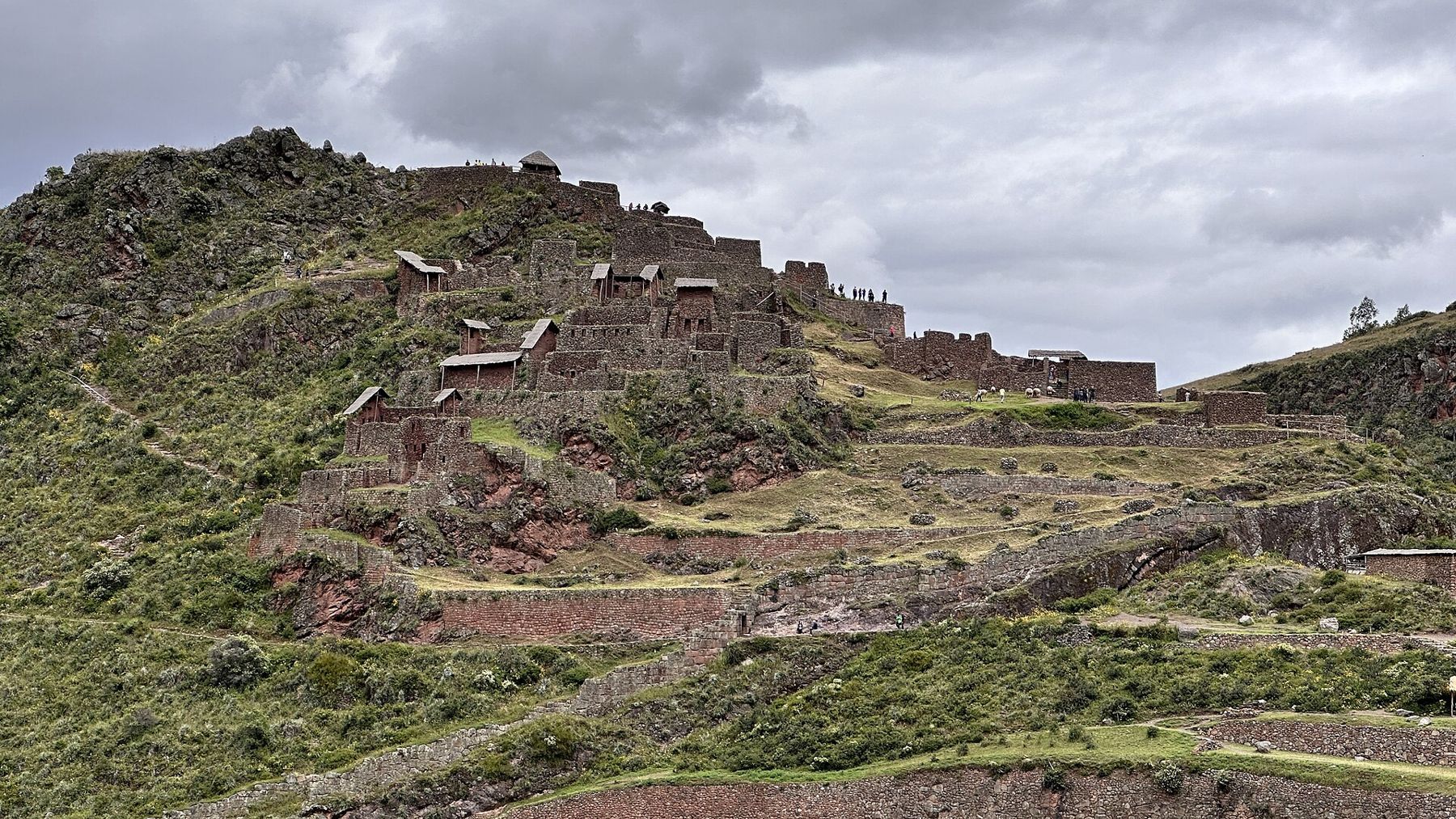
Most people drive up to the upper entrance and walk down through the ruins and terraces to the town. It is a long walk, mostly downhill on stone steps, and it takes a few hours. Go in the morning, when the light is clear and the site is quiet, carry water, and take your time.
Days 3 and 4: Chinchero, Moray and Maras
From the valley floor, the roads climb up onto the high plateau to the south, a rolling plain of fields at around 3,500 metres, with the snow peaks of the Cordillera Urubamba across the valley. This is colder, windier country, and the air is thinner than in Cusco. Visit only after a day or two in the valley, and walk slowly.
Chinchero, on the plateau, is a village with a colonial church built on Inca foundations, terraces and a busy weaving tradition. Local women demonstrate how wool is spun, dyed with plants and woven on backstrap looms.
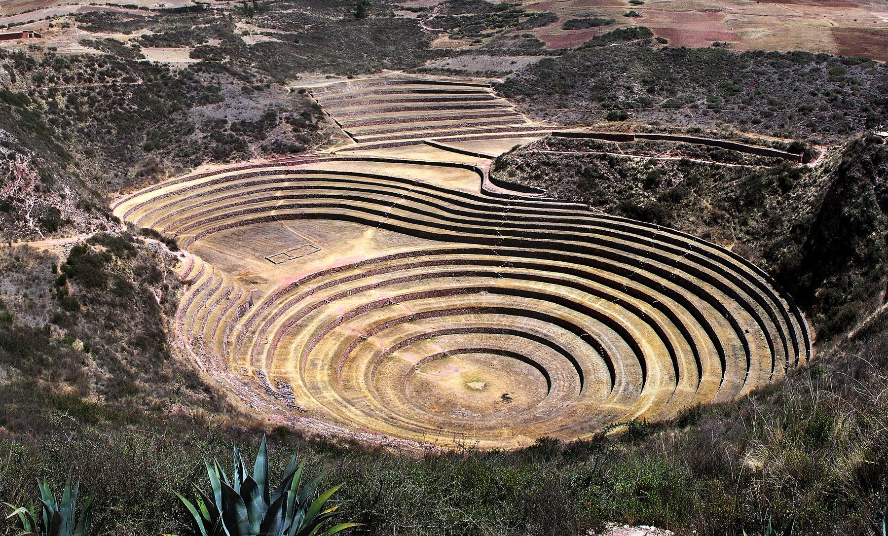
Moray lies in a fold of the plateau. Here the Inca shaped natural hollows in the ground into great circular terraces, ring below ring, descending like an amphitheatre into the earth. The temperature differs from the top ring to the bottom, and many believe the Inca used the site to study how crops grew in different conditions. The idea is widely repeated, though not proven. Either way, the shape is extraordinary.
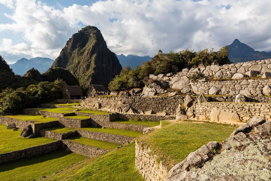 2,430 mMachu Picchu, on the saddle between two peaks
A few kilometres away, a dirt road leads to the edge of a steep side valley and the salt pans of Maras. A salty spring emerges from the mountain, and its water is led through a maze of tiny channels into thousands of shallow pools cut into the hillside. As the water evaporates in the sun, the salt crystallises and is scraped up by hand. People have worked the pans since at least Inca times, and local families still work them today.
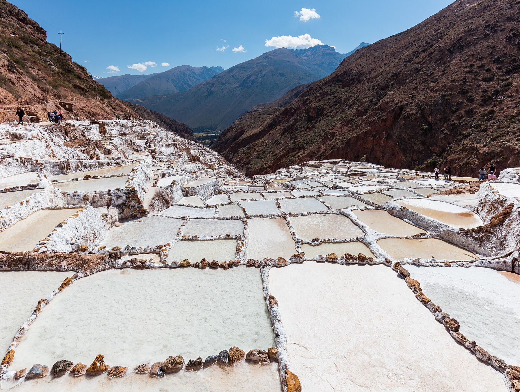
From above, the pools form a patchwork of white, cream and pale brown. Walk on the paths only, and do not step into the pools; they are people's livelihood. Bags of salt are sold at the entrance, and they make a good present to take home.
Day 5: Ollantaytambo
At the western end of the valley lies Ollantaytambo, at about 2,800 metres. The town is one of the best preserved Inca settlements in Peru. Its old quarter keeps the Inca street grid, with narrow lanes of stone walls, and water still runs in stone channels along the streets. Many people live in houses built on Inca foundations, around courtyards entered through stone doorways.
Above the town rises the temple complex, often called the fortress. A long flight of terraces climbs steeply up the hillside to a group of buildings at the top, among them a wall of six huge, pink stone slabs, fitted together with thin strips of stone between them. The stone was quarried on the mountain across the river and somehow brought up here. The work was never finished, and some blocks still lie along the route.
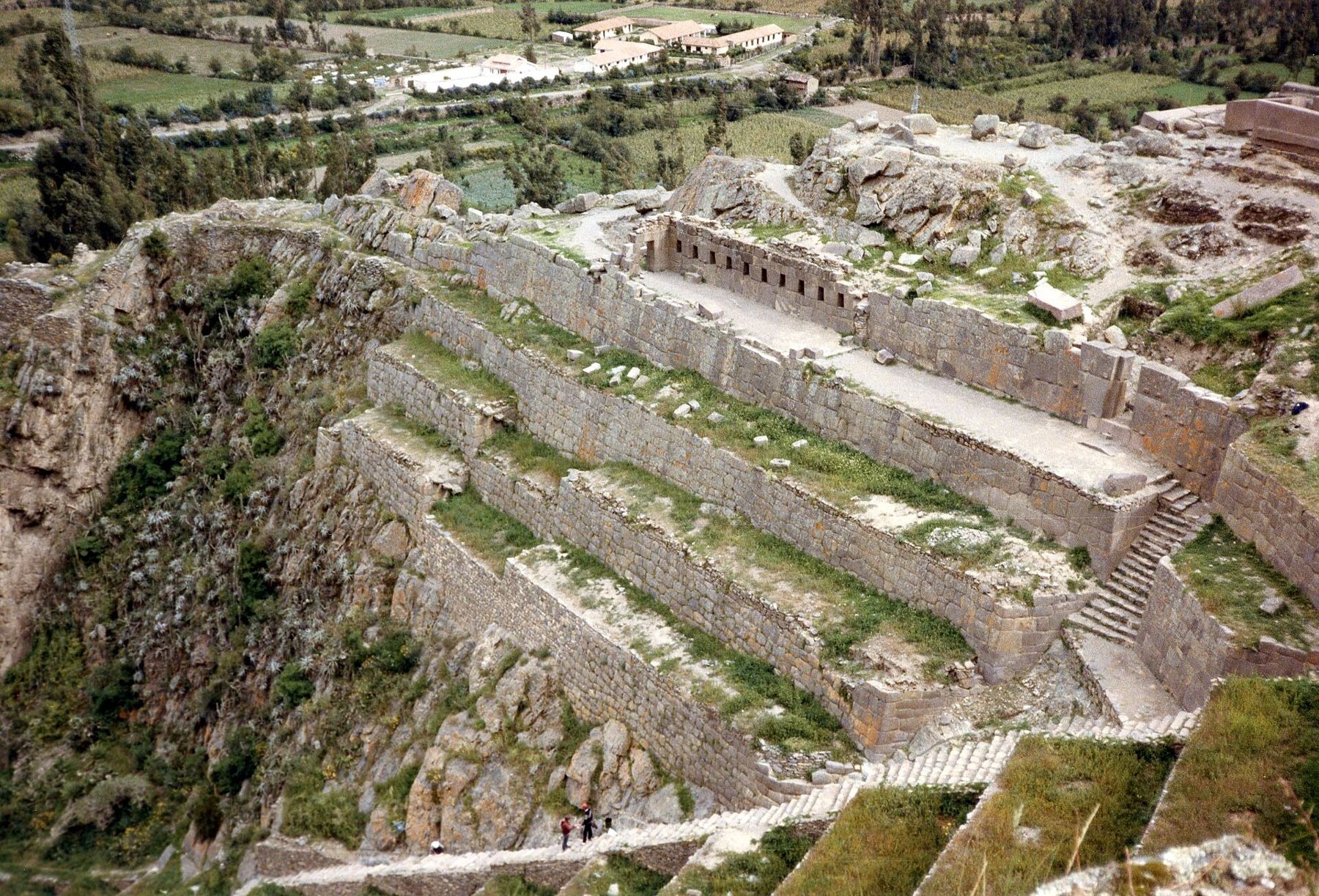
In 1537, Manco Inca made a stand here against the Spanish, and his forces held off an attack on the terraces before he withdrew deeper into the mountains. The climb to the top is steep and the steps are high. Go slowly, early in the day.
Across the town, on the opposite hillside, are the ruins of Inca storehouses, reached by a steep path. They give a fine view over the town and the fortress, especially in the late afternoon.
Day 6: Toward Machu Picchu
Ollantaytambo is the main departure point for the train to Machu Picchu. The railway follows the river downstream into a narrowing gorge, where the dry valley gives way to forest and the air grows warmer and damper. It is one of the great train rides of the Andes, and it takes you from the valley down to the citadel, some 400 metres lower.
Where the profile goes next
The Sacred Valley sits between two very different altitudes. Above it is Cusco, the Inca capital, at 3,400 metres, with its stone walls and cold nights. Below it, down the gorge, is Machu Picchu. Beyond Cusco, the road climbs higher still, to the passes of the Altiplano and the shores of Lake Titicaca, and to the coloured slopes of Vinicunca, above 5,000 metres.
Before you leave the valley, stand in one of the old streets of Ollantaytambo in the evening. The water runs in its stone channels, the last sun touches the terraces on the mountain, and the fields below turn gold.