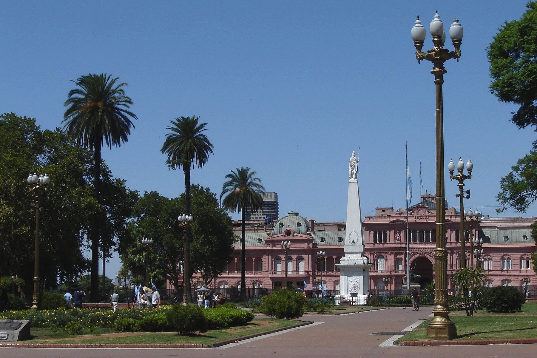
Buenos Aires is built on the flat bank of the Río de la Plata, the wide brown estuary where the Paraná and the Uruguay meet the Atlantic. The city stands about twenty-five metres above the sea at most, and the land is so level that the bluffs above the old shoreline are the only hills. This walk follows the oldest part of the city south, from the government square to the old port of La Boca, a distance of around four kilometres.
Altitude plays no part here. The conditions that shape the walk are the temperate climate and its humidity. Summers, from December to February, are hot and sticky, with heavy thunderstorms; winters, from June to August, are cool and damp, with grey days and chilly nights, though frost is rare. Spring and autumn are the easiest walking seasons, with mild days and jacaranda trees flowering purple in November. Wear comfortable shoes for the uneven pavements, and in summer carry water and walk in the shade of the old buildings.
Plaza de Mayo
The walk begins in the square where Argentina's independence began. The May Revolution of 1810, which removed the Spanish viceroy and set up a local government, gave the plaza its name. In the centre stands the Pirámide de Mayo, a white obelisk raised the following year to mark the first anniversary. Palm trees and jacarandas shade the paths, and the square is the place for the country's celebrations and its protests.
Look down at the paving around the pyramid. Painted on the ground are white headscarves, the symbol of the Mothers of the Plaza de Mayo. During the military dictatorship of 1976 to 1983, thousands of people were disappeared, and from 1977 their mothers began walking around this pyramid on Thursday afternoons, demanding to know what had happened to their children. Their march became one of the best-known human rights protests in the world.
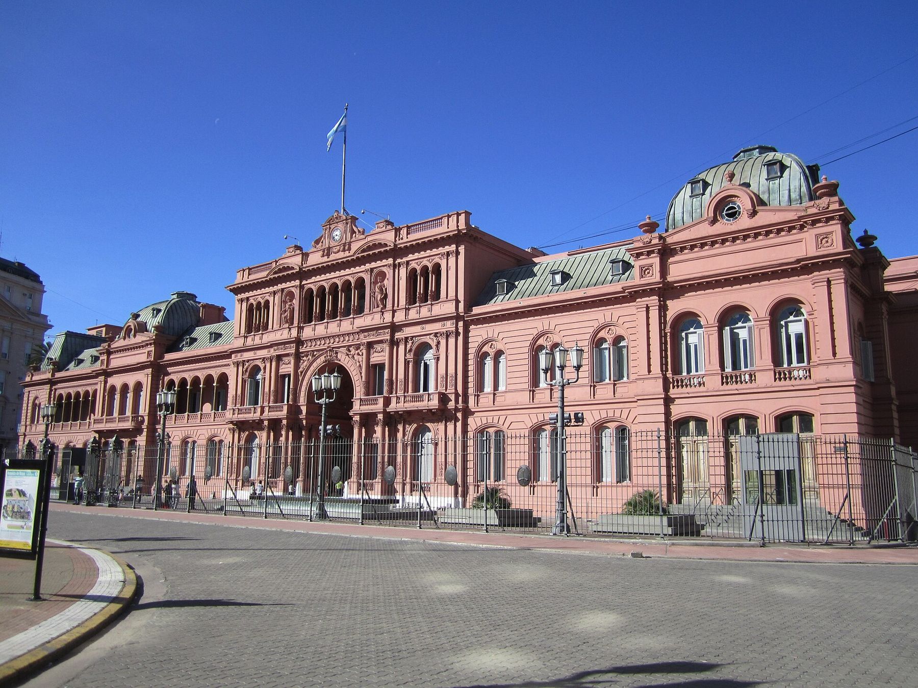
Casa Rosada
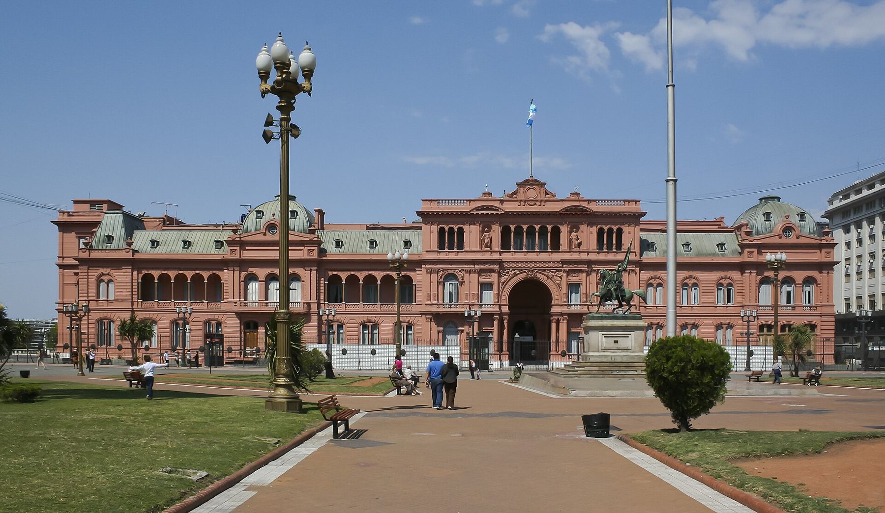
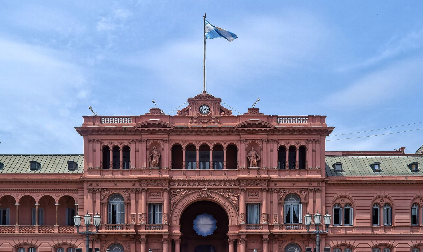
At the east end of the square stands the Casa Rosada, the pink palace that houses the office of the president. Its colour is said to have been chosen in the nineteenth century, and the explanations vary. From the balconies facing the square, presidents and public figures have addressed the crowds below, and the balcony is part of the country's political memory.
Guided visits to parts of the palace have been offered on weekends, though arrangements change. Even from outside, the building is worth a slow look, with its arches, its balustrades and the city's financial towers rising behind it.
Cabildo
At the west end of the square, across from the Casa Rosada, stands the Cabildo, the white colonial town hall with its arched gallery and bell tower. It was here, in May 1810, that the open council met and the revolution began. The building was cut down on both sides in the late nineteenth and early twentieth centuries to make room for new avenues, so it is smaller than it was. It now holds a museum on the revolution and the colonial city.
Next to it, on the north side of the square, the Metropolitan Cathedral, with its neoclassical columns, holds the tomb of General José de San Martín, the hero of the independence wars, guarded by soldiers in historic uniform.
 50 mValparaíso's hills
Defensa street
From the south-west corner of the square, Defensa runs south. It is one of the oldest streets in the city, named for the defence of Buenos Aires against the British invasions of 1806 and 1807. Walk it slowly. Past the churches of San Francisco and Santo Domingo, the buildings grow lower, the pavement narrower, and the street becomes cobbled as you cross into San Telmo, the city's oldest barrio.
San Telmo was home to wealthy families until 1871, when a yellow fever epidemic drove them north. Their large houses were divided into conventillos, crowded tenements for the immigrants arriving from Italy, Spain and elsewhere. Many of those houses still stand, with long courtyards visible through the doorways, and the neighbourhood's mix of decay and grace dates from then.
Plaza Dorrego
At the corner of Defensa and Humberto Primo, Plaza Dorrego is San Telmo's small square, shaded by trees and lined with old buildings. On Sundays the antiques fair fills the square, and the street fair spreads along Defensa for many blocks in both directions, with stalls selling crafts, old maps, soda siphons, vinyl and leather. Tango dancers perform on the cobbles and musicians play on corners.
The fair is crowded, and pickpockets work the crowds. Keep bags zipped and in front, and wallets out of back pockets. On other days the square is quiet, and the old market a block away, a large iron-roofed hall, sells produce, food and antiques.
Parque Lezama
Continue south on Defensa to the green slope of Parque Lezama. Tradition places the first founding of Buenos Aires near here, by Pedro de Mendoza in 1536; that settlement was abandoned, and the city was founded again in 1580 by Juan de Garay. The park sits on the old bluff above the river, with tall trees, a monument to Mendoza and a Russian Orthodox church with blue onion domes across the street. On the park's edge, the National Historical Museum is housed in an old mansion.
From here the walk descends towards the river.
Caminito, La Boca
La Boca stands at the mouth of the Riachuelo, the river that marks the city's southern edge. It was the port where immigrants, many from Genoa, came to work in the docks and shipyards. They built their houses of wood and corrugated iron and painted them with leftover ship paint, in whatever colours were available, which is the story told for the bright patchwork houses here.
Caminito is a short, curving street of these painted houses, turned into an open-air street museum in the late 1950s with the help of the painter Benito Quinquela Martín, whose museum stands nearby on the riverside. Its name comes from a well-known tango. The street is lively, colourful and crowded, with dancers posing for photos and stalls of paintings.
La Boca beyond the few blocks around Caminito is a working neighbourhood with real poverty, and some streets are not safe for visitors, especially after dark. Visit by day, stay within the busy tourist area, and take a taxi or app car back rather than walking. For more on keeping safe in big cities, see money and staying safe.
Beyond the city
From Buenos Aires, the land runs flat in every direction. North up the Paraná lie the falls at Iguazu, on the border with Brazil. West across the pampas, the land rises gently to the wine country of Mendoza, under the Andes, and south, the Patagonian plateau leads to Bariloche and the lakes, where the cold begins. Over the mountains, the Pacific port of Valparaíso climbs its own hills.
Back on the Riachuelo, the old iron transporter bridge stands over the water at the end of the walk, a tall frame from the port's working past.